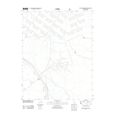
2011 Map of Powell Mountain NE
USGS Topo · Published 2011About this map
Cottonwood Canyon and the surrounding high desert terrain of Mineral County define this early 21st-century landscape. The area is marked by a network of drainage systems and primitive access routes, reflecting a region primarily managed for resource extraction and land management. Cottonwood Creek and Willow Creek carve through the arid topography, leading toward deep incisions like Willow Canyon and Bromide Canyon. The map reveals a specific infrastructure of forest service and local roads, including 750 and 751a, which navigate the complex elevations of the Powell Mountain NE quadrangle. This survey provides a precise view of the geographic relationships between named landforms such as Pamlico Canyon and the seasonal watercourses that shape the local environment.
Find a feature on this map
13 named features on this map. Tap any name to fly to it.
Don’t see what you’re looking for? This feature index may not catch every label — zoom into the map to look around manually.
Map Details
Editions of this 2011 Powell Mountain NE Map
This is the sole edition of this map. No revisions or reprints were ever made.
Other maps of this area

1909 · Hawthorne
USGS Topo · 1:250,000

1911 · Hawthorne
USGS Topo · 1:250,000

1915 · Hawthorne
USGS Topo · 1:250,000

1948 · Walker Lake
USGS Topo · 1:250,000

1955 · Powell Mtn
USGS Topo · 1:62,500

1955 · Hawthorne
USGS Topo · 1:62,500

1957 · Walker Lake
USGS Topo · 1:250,000

1962 · Walker Lake
USGS Topo · 1:250,000

1964 · Walker Lake
USGS Topo · 1:250,000

1967 · Pamlico
USGS Topo · 1:24,000