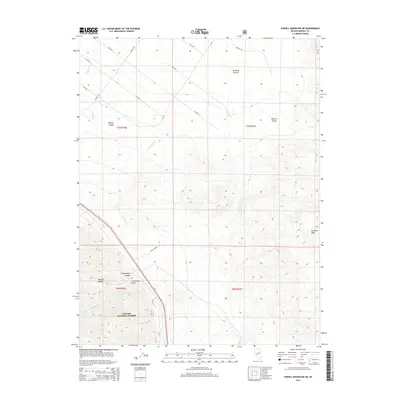
2014 Map of Powell Mountain NE
USGS Topo · Published 2014About this map
Wassuk Range and the Garfield Hills dominate this high-desert landscape in Mineral County, where steep drainage systems have carved deep corridors such as Bromide Canyon and Willow Canyon. The southern portion of the map encompasses a section of the Toiyabe National Forest, indicating a transition into protected mountainous terrain. A rigid grid of desert roads, including Middle Rd and various numbered avenues like 4th Ave S, suggests planned land divisions or access routes for mining and ranching interests typical of this Nevada region. Ephemeral water sources like Cottonwood Cr and Willow Cr provide the primary hydrologic features, winding through the canyons. The presence of Pole Line Rd underscores the infrastructure required to connect these remote mountain reaches with the wider utility grid.
Find a feature on this map
23 named features on this map. Tap any name to fly to it.
Don’t see what you’re looking for? This feature index may not catch every label — zoom into the map to look around manually.
Map Details
Editions of this 2014 Powell Mountain NE Map
This is the sole edition of this map. No revisions or reprints were ever made.
Other maps of this area

1909 · Hawthorne
USGS Topo · 1:250,000

1911 · Hawthorne
USGS Topo · 1:250,000

1915 · Hawthorne
USGS Topo · 1:250,000

1948 · Walker Lake
USGS Topo · 1:250,000

1955 · Powell Mtn
USGS Topo · 1:62,500

1955 · Hawthorne
USGS Topo · 1:62,500

1957 · Walker Lake
USGS Topo · 1:250,000

1962 · Walker Lake
USGS Topo · 1:250,000

1964 · Walker Lake
USGS Topo · 1:250,000

1967 · Pamlico
USGS Topo · 1:24,000