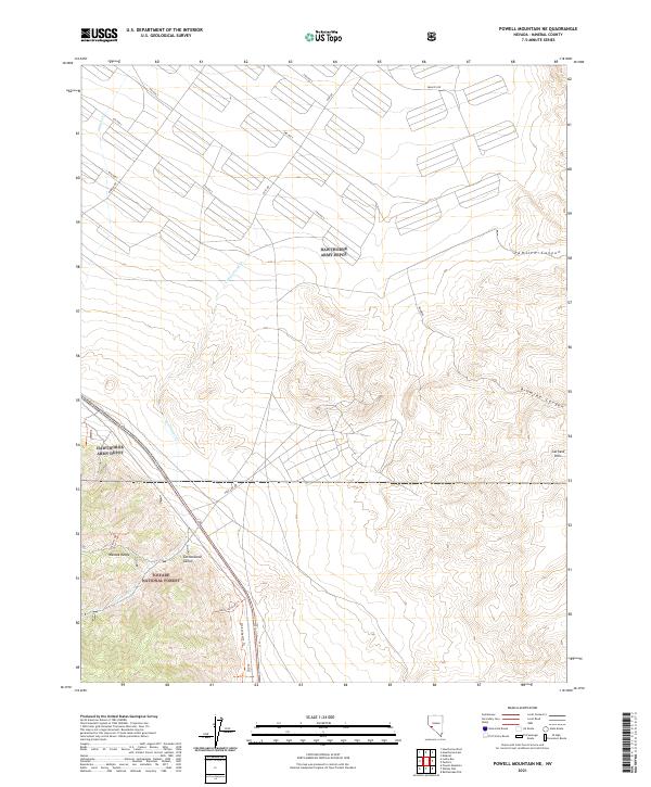
2021 Map of Powell Mountain NE
USGS Topo · Published 2021About this map
The Hawthorne Army Depot dominates this portion of Mineral County, its vast grid of industrial roadways like East Rd, Middle Rd, and Pamlico Rd cutting across the desert floor. This military landscape is defined by the strict organization of ammunition storage and transport infrastructure, set against a backdrop of dramatic natural elevation. To the west, the Wassuk Range rises sharply, partially contained within the Toiyabe National Forest, where steep drainages like Cottonwood Cañon meet the valley floor.
Find a feature on this map
25 named features on this map. Tap any name to fly to it.
Don’t see what you’re looking for? This feature index may not catch every label — zoom into the map to look around manually.
Map Details
Editions of this 2021 Powell Mountain NE Map
This is the sole edition of this map. No revisions or reprints were ever made.
Other maps of this area

1909 · Hawthorne
USGS Topo · 1:250,000

1911 · Hawthorne
USGS Topo · 1:250,000

1915 · Hawthorne
USGS Topo · 1:250,000

1948 · Walker Lake
USGS Topo · 1:250,000

1955 · Powell Mtn
USGS Topo · 1:62,500

1955 · Hawthorne
USGS Topo · 1:62,500

1957 · Walker Lake
USGS Topo · 1:250,000

1962 · Walker Lake
USGS Topo · 1:250,000

1964 · Walker Lake
USGS Topo · 1:250,000

1967 · Pamlico
USGS Topo · 1:24,000