
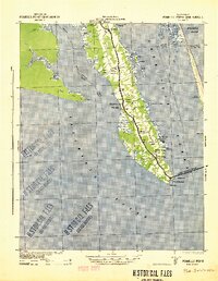
1940 Map of Powells Point
USGS Topo · Published 1940About this map
Currituck Sound and the North River converge at the southern tip of the mainland in this 1940s-era coastal study. The peninsula is anchored by a string of small settlements along the central roadway, including Jarvisburg, Powells Point, and Harbinger. This area reflects the maritime and agricultural life of the Outer Banks region just as the Wright Memorial Bridge began to transform the local economy by providing a direct link across the sound to the coast.
Find a feature on this map
34 named features on this map. Tap any name to fly to it.
Don’t see what you’re looking for? This feature index may not catch every label — zoom into the map to look around manually.
Map Details
Editions of this 1940 Powells Point Map
2 editions found
Other maps of this area

1940 · Barco
USGS Topo · 1:62,500

1940 · Kitty Hawk
USGS Topo · 1:62,500

1940 · Wade Point
USGS Topo · 1:62,500

1943 · Wade Point
USGS Topo · 1:62,500

1943 · Columbia
USGS Topo · 1:125,000

1943 · Roanoke Island
USGS Topo · 1:125,000

1946 · Eastville
USGS Topo · 1:250,000

1946 · Currituck Sound
USGS Topo · 1:250,000

1948 · Wade Point
USGS Topo · 1:62,500

1948 · Elizabeth City
USGS Topo · 1:62,500