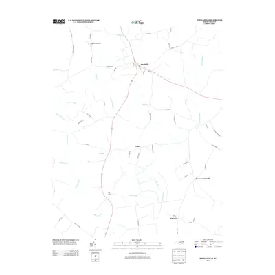
2013 Map of Powellsville
USGS Topo · Published 2013About this map
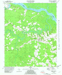
Powellsville serves as the primary hub of this eastern North Carolina landscape, where small rural settlements are separated by an extensive network of wetlands. Small communities like Cremo, Holly Grove, and Elm Grove dot the countryside, connected by roads such as Snow Ave and Wynn Rd. The geography is defined by its drainages, including Quioccosin Swamp, Wildcat Swamp, and the interestingly named Barbeque Swamp. A notable modern landmark is Dragonfly Field Airport, situated north of Stony Cr. The map reveals a land use pattern dominated by agricultural tracts and timberlands, with scattered crossroads such as Buzzards Crossroads marking historic intersection points. Narrow waterways like Ahoskie Cr and Cucklemaker Creek wind through the terrain, illustrating the hydrologic complexity of Bertie County's interior.
Find a feature on this map
61 named features on this map. Tap any name to fly to it.
Don’t see what you’re looking for? This feature index may not catch every label — zoom into the map to look around manually.
Map Details
Editions of this 2013 Powellsville Map
This is the sole edition of this map. No revisions or reprints were ever made.
Other maps of this area

1908 · Winton
USGS Topo · 1:62,500

1953 · Norfolk
USGS Topo · 1:250,000

1972 · Republican
USGS Topo · 1:24,000

1972 · Aulander
USGS Topo · 1:24,000

1977 · Union
USGS Topo · 1:24,000
1981 · Windsor North
USGS Topo · 1:24,000

1982 · Powellsville
USGS Topo · 1:24,000
1982 · Colerain
USGS Topo · 1:24,000
1982 · Merry Hill
USGS Topo · 1:24,000
1982 · Harrellsville
USGS Topo · 1:24,000