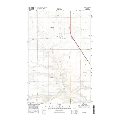
2017 Map of Power
USGS Topo · Published 2017About this map
The community of Power serves as the focal point for this landscape along the border of Teton and Cascade counties. The settlement is structured around a grid of streets including Central Ave and Rainbow Ave, with the Power Community Cem located to the north. This high-plains geography is defined by a series of dramatic terrace levels, labeled here as Third Bench, Second Bench, and First Bench, which descend toward the drainage of Muddy Creek.
Find a feature on this map
37 named features on this map. Tap any name to fly to it.
Don’t see what you’re looking for? This feature index may not catch every label — zoom into the map to look around manually.
Map Details
Editions of this 2017 Power Map
This is the sole edition of this map. No revisions or reprints were ever made.
Other maps of this area

1886 · Great Falls
USGS Topo · 1:250,000

1949 · Vaughn
USGS Topo · 1:62,500

1950 · Fairfield
USGS Topo · 1:62,500

1950 · Dutton
USGS Topo · 1:62,500

1950 · Collins
USGS Topo · 1:62,500

1952 · Vaughn
USGS Topo · 1:62,500

1954 · Great Falls
USGS Topo · 1:250,000

1957 · Great Falls
USGS Topo · 1:250,000

1976 · Great Falls North
USGS Topo · 1:100,000
1983 · Vaughn NE
USGS Topo · 1:24,000