Old Maps of Teton County, Montana
Explore 459 old maps of Teton County, spanning from 1886 to today. These high-resolution historic maps reveal how streets, neighborhoods, landmarks, and natural features evolved over time — perfect for genealogy, metal detecting, research, and local history exploration.
What you can do with these maps:
- See how Teton County changed over time: Compare historical maps to modern-day views to trace roads, homesites, rail lines & more.
- View detailed metadata: Each map includes creators, publishers, year, scale, and archive source.
- Overlay maps with satellite & LiDAR: Visualize the past alongside modern tools to explore terrain & human change.
- Trusted historical sources: Maps sourced from the USGS, Library of Congress, and other archives.
- Access maps your way: View online, download high-res files, or order prints for personal or research use.
Start exploring old maps of Teton County to uncover forgotten places, hidden landmarks, and the deep history beneath your feet.
Teton County, MT maps
(459)- 1886 Map of Great Falls
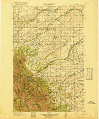
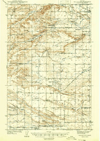
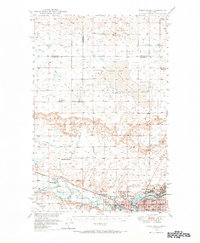
 1886 Great Falls1886 Print · USGSCentral Montana in the mid-1880s is defined by its great river systems and the early footprints of frontier outposts. Researchers can trace the early development of Great Falls, find the site of St. Peter's Mission, and locate river settlements like Truly and Fort Shaw.4 unique versions available
 - 1903 Map of Saypo
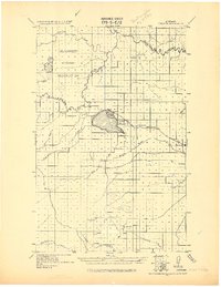
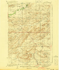
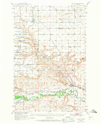
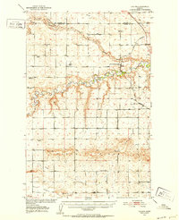
 1903 Saypo1903 Print · USGSTeton and Lewis and Clark counties appear at the dawn of the century as a landscape of remote mountain forest reserves and early prairie homesteads. Researchers can trace the holdings of pioneer families at Clark Bros Ranch and Campbell's Ranch or locate early industry at McGunks Sawmill and the local Coal Mine.7 unique versions available
 - 1913 Map of Marias Pass
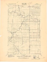
 1913 Marias Pass1913 Print · USGSThe Continental Divide and the Great Northern Railroad meet at the crest of the Rockies in the years just after Glacier's establishment. Local historians can trace early rail stations like Lubec, the Midvale settlement, and remote outposts such as Three Forks Rangers Cabin.3 unique versions available
 - 1914 Map of Heart Butte, 1959 Print
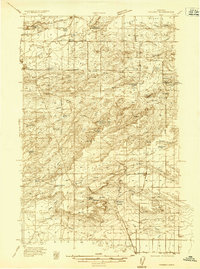
 1914 Heart Butte1959 Print · USGSThe foothills and plains of Pondera and Teton Counties are captured here in the early 1900s as the wilderness was being organized by early forestry and ranching. Genealogists can trace early homestead life via the Terryman School, Family, and the Blackleaf Ranger Station.
 - 1918 Map of Heart Butte
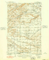
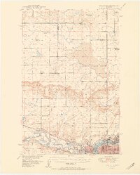
 1918 Heart Butte1918 Print · USGSThe northern Montana plains meet the high Divide in the early twentieth century, showing the interface of the Blackfeet Indian Reservation and the national forest. Genealogists and historians can locate early rural schools like Jensen School and frontier outposts such as Hagans Crossing and the Blackleaf Ranger Station.3 unique versions available
 - 1920 Map of Choteau
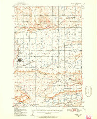
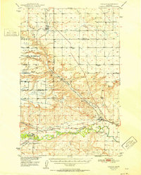
 1920 Choteau1920 Print · USGSNorth-central Montana in the early twentieth century shows a landscape being reshaped by irrigation canals and competing rail lines. Family historians can trace early settlements like Agawam, Bole, and Gilman, or locate regional landmarks like Priest Butte and Pishkun Reservoir.
 - 1920 Map of Dupuyer
 1920 Dupuyer1920 Print · USGSHigh plains ranching and early irrigation projects define this 1920s survey of the Montana frontier. Genealogists and historians can trace the early rail stops and homestead hubs at Valier, Pendroy, and Manson along the Montana Western R. R. line.
 - 1920 Map of Conrad
 1920 Conrad1920 Print · USGSNorthern Montana plains at the height of the homesteading era are captured here during a period of rapid rail-led growth. Researchers can trace early postal locations like Omholt P. O. and the junction of the Great Northern R. R. in towns like Conrad and Brady.
 - 1936 Map of Pendroy
 1936 Pendroy1936 Print · USGSThe railhead at Pendroy and the neighboring ranching communities were thriving in the mid-1930s before the era of modern consolidation. Researchers can trace family homesteads like Jensen Ranch or investigate early resource extraction at the Hubbard Mine and Oil Well sites.2 unique versions available
 - 1938 Map of Gallup City, 1942 Print
 1938 Gallup City1942 Print · USGSThe ranching country of Pondera and Teton counties comes to life in the late 1930s as a landscape of remote schoolhouses and family homesteads. Researchers can trace the legacy of early settlers at Graham Ranch or locate long-gone rural schools like Earhart Sch and Rowe Kamp Sch.2 unique versions available
 - 1941 Map of Pendroy
 1941 Pendroy1941 Print · USGSThe Montana high plains meet the Rocky Mountain Front in this pre-war survey of the Teton and Pondera county line. Local historians can trace the early ranching economy through landmarks like the Soberup Ranch and Hall Ranch, or locate coal operations at the Hubbard Mine.2 unique versions available
 - 1942 Map of Gallup City, 1949 Print
 1942 Gallup City1949 Print · USGSThe Pondera and Teton County borderlands come to life in this pre-war survey, showing a landscape of high benches and deep coulees. Researchers can trace the rural school system at Porter Bench Sch and Erickson Sch, or locate family-named landmarks like Graham Ranch and Maucki.
 - 1949 Map of Timber Coulee, 1963 Print
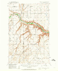 1949 Timber Coulee1963 Print · USGSTeton and Chouteau counties are shown here in the late 1940s, when the agricultural life of the Montana plains was tied to the river valley and small country schoolhouses. Researchers can locate the Jensen Elevator, follow the historic Bootlegger Trail, and find local landmarks like Knee Church.2 unique versions available
 - 1949 Map of Great Falls, 1966 Print
 1949 Great Falls1966 Print · USGSMid-century Great Falls and the Missouri River basin are shown here during a period of post-war industrial and educational expansion. Researchers can trace the heritage of the area via the Bootlegger Trail, the Black Eagle Dam, and schools like Ursuline Academy and McKinley Sch.
 - 1949 Map of Vaughn, 1968 Print
 1949 Vaughn1968 Print · USGSThe Sun River valley is captured here in the late 1940s, showing a landscape defined by industrial rail lines and sophisticated irrigation. You can trace the path of the Great Northern railroad through Vaughn or locate the Gettel School and Sun River Cemetery.
 - 1950 Map of Timber Coulee
 1950 Timber Coulee1950 Print · USGSMontana's high prairie and river breaks are documented here in the mid-1940s, showing a landscape defined by the winding Teton River. Genealogists and local historians can trace the locations of the Knee Church, the Jensen Elevator, and early rural schools like Promised Land School.
 - 1950 Map of Fairfield, 1952 Print
 1950 Fairfield1952 Print · USGSIn the early 1950s, the Teton County prairie was a landscape of irrigation canals and rail lines centered on Fairfield. Trace the development of the Missouri River Basin through features like the Greenfield Main Canal, Old Fort Shaw, and the Great Northern railroad.4 unique versions available
 - 1950 Map of Dutton, 1952 Print
 1950 Dutton1952 Print · USGSDutton and the surrounding Teton County plains are shown in the early 1950s as a thriving rail-side agricultural community. Genealogists can trace a network of rural schoolhouses like Doheney School and Pleasant School, alongside the Great Northern railroad line.3 unique versions available
 - 1950 Map of Collins, 1952 Print
 1950 Collins1952 Print · USGSTeton County and Pondera County meet along the meanders of the Teton River at the height of the post-war ranching and rail era. Researchers can trace the rural school network including South Liberty Sch, or locate family landmarks like Beck Cem and the grain hub at Zim Elevator.2 unique versions available
 - 1951 Map of Great Falls
 1951 Great Falls1951 Print · USGSGreat Falls and the surrounding Cascade County plains come alive in this mid-century survey of the Missouri River basin. Genealogists and local historians can trace the early layout of Black Eagle, locate the Ursuline Academy, and follow the historic Bootlegger Trail.2 unique versions available
 - 1952 Map of Vaughn
 1952 Vaughn1952 Print · USGSThe Montana benchlands north of Great Falls come into focus in the early fifties, where the Sun River and Muddy Creek meet. Genealogists and historians can trace the irrigation canals, the Great Northern rail lines, and landmarks like Sun River Cemetery or the Gettel School.
 - 1954 Map of Great Falls
 1954 Great Falls1954 Print · USGSThe Missouri River valley in the mid-1950s is shown at a time of significant industrial and military growth. Genealogists and historians can locate early schools and rail stops like Tiger Butte Community Center, Fort Benton, and the Anaconda Wire Plant.4 unique versions available
 - 1954 Map of Shelby, 1967 Print
 1954 Shelby1967 Print · USGSNorthern Montana's Hi-Line is captured in the mid-fifties, showing a landscape shaped by the Great Northern rail and early oil development. Trace family roots in Shelby and Conrad, or locate rural landmarks like Goose Bill Butte and the Rocky Boys Indian Reservation.3 unique versions available
 - 1955 Map of Choteau, 1978 Print
 1955 Choteau1978 Print · USGSWestern Montana during the mid-fifties is captured here as a land of rugged high-country wilderness and vital eastern plains irrigation. Genealogists and historians can locate remote outposts like Condon, the communal Miller Colony, and the rail stops of the Chicago Milwaukee St Paul and Pacific.
 - 1957 Map of Choteau
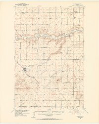
 1957 Choteau1957 Print · USGSMontana's mountain front meets the eastern plains in the mid-fifties, showing the transition from forested wilderness to irrigated ranch land. Genealogists and historians can trace the rail lines of the Great Northern and find settlements like Choteau, Augusta, and Seeley Lake.
Showing maps 1-25 of 459
Top cities of Teton County
Frequently asked questions
- What are the different types of historical maps available for Teton County?
- What is the oldest map of Teton County?
- Where can I purchase historical maps of Teton County for my home or office?
- Where can I download high-res historical maps of Teton County?
- Are there historical topographic maps available for Teton County?
- Is there historical aerial imagery available for Teton County?
- Where are historical maps of Teton County sourced from?