1990s Maps of Teton County, Montana
Explore 21 historic maps of Teton County from the 1990s. These maps offer a rare glimpse into what life looked like during the 1990s — showing old roads, neighborhoods, homes, and landmarks that have changed or disappeared over time.
Whether you're researching your family's past, planning a metal detecting trip, or studying how Teton County's landscape evolved across the 1990s, these high-resolution maps are a powerful tool for exploring the history of this region.
- Focus on a specific era: All maps on this page are from the 1990s, giving you a focused view of this time period.
- See what’s changed: Compare century-old streets, trails, and buildings to today's modern landscape using overlays and satellite layers.
- Research with precision: Use these maps for genealogy, historical research, land use analysis, or educational projects.
- View, download, or print: Maps are fully viewable online in high resolution, and can be downloaded or printed for your own records.
Start exploring Teton County's history through authentic maps from the 1990s. This is your window into the past.
Teton County, MT maps
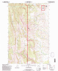
(21)- 1995 Map of Swift Reservoir, 1997 Print
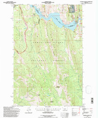
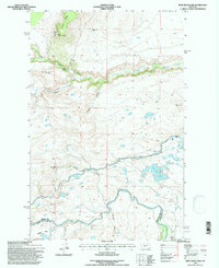
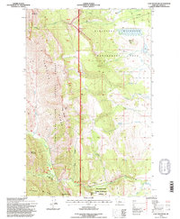
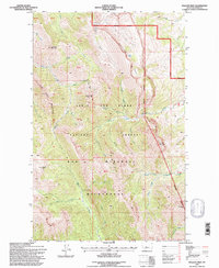
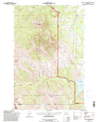 1995 Swift Reservoir1997 Print · USGSThe Rocky Mountain Front meets the Blackfeet Nation in the 1990s at this dramatic mountain boundary. Trace the sharp ridges of the Sawtooth Range to peaks like Heart Butte and the waters of Swift Reservoir.
 - 1995 Map of Gates Park, 1997 Print
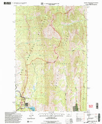
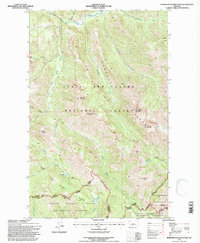
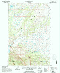
 1995 Gates Park1997 Print · USGSThe Montana Rockies meet the North Fork Sun River in the mid-1990s within the Bob Marshall Wilderness. Researchers can trace the high-country paths of the Continental Divide National Scenic Trail and locate the remote structures at Gates Park.
 - 1995 Map of Gateway Pass, 1997 Print
 1995 Gateway Pass1997 Print · USGSThe Montana high country of the mid-1990s is captured here, centered on the Continental Divide and the Bob Marshall Wilderness. Hikers and researchers can trace remote paths toward Gateway Pass and locate secluded landmarks like Sabado Cabin and Mount Patrick Gass.
 - 1995 Map of Lake Theboe, 1997 Print
 1995 Lake Theboe1997 Print · USGSThe Montana foothills in the mid-nineties were a landscape of storied family ranches and protected wetlands. Genealogists and historians can trace the legacy of the Saypo (Site) and the Bellview Sch or locate family landmarks like Lane Ranch and Salmond Ranch.
 - 1995 Map of Patricks Basin, 1997 Print
 1995 Patricks Basin1997 Print · USGSThe Rocky Mountain Front meets the edge of the plains in the mid-1990s, where the massive Gibson Reservoir cuts through the canyon walls. Researchers can trace the remote trails of the Bob Marshall Wilderness and locate landmarks like the Gibson Lake Lodge and Allan Mountain.
 - 1995 Map of Porphyry Reef, 1997 Print
 1995 Porphyry Reef1997 Print · USGSThe Montana backcountry is preserved here in the mid-1990s at the intersection of the Flathead and Lewis and Clark national forests. Trace remote hiking routes through Sun River Pass or follow the Continental Divide Scenic Trail past landmarks like Washboard Reef.
 - 1995 Map of Glenn Creek, 1997 Print
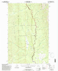
 1995 Glenn Creek1997 Print · USGSThe Montana wilderness in the mid-nineties remains a landscape of high peaks and protected preserves. Hikers and historians can trace primitive routes along Two Shacks Trail or locate remote natural landmarks like Hazard Lake and Sulphur Creek Lick.
 - 1995 Map of Castle Reef, 1997 Print
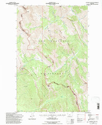
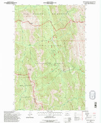
 1995 Castle Reef1997 Print · USGSThe Sawtooth Range meets the Sun River during the mid-nineties in this detailed look at the Montana backcountry. Genealogists and researchers can trace local family holdings like Kellogg Ranch and Davy High Ranch near Wagner Basin.
 - 1995 Map of Split Rock Lake, 1997 Print
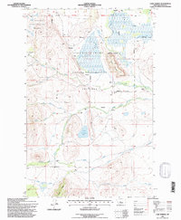
 1995 Split Rock Lake1997 Print · USGSIn the mid-1990s, the border of Teton and Lewis and Clark Counties preserved a landscape of evolving ranching and vital irrigation. Genealogists and historians can trace former homesteads like Carlson Ranch (Aband) or locate the Indian Burial Ground near the Sun River.
 - 1995 Map of Arsenic Mountain, 1997 Print
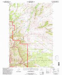
 1995 Arsenic Mountain1997 Print · USGSThe Rocky Mountain Front in the 1990s presents a remote landscape of high peaks and protected wilderness along the Sun River. Local historians can locate the K-L Ranch, trace the Mortimer Gulch Trail, and find the historic White Cabin (Site).2 unique versions available
 - 1995 Map of Barr Creek, 1997 Print
 1995 Barr Creek1997 Print · USGSThe Sun River country comes into focus in the mid-1990s, where wildlife conservation and ranching meet at the Lewis and Clark County line. Trace irrigation history through the Geldrich Ditch and Kirkaldie Canal, or locate the Morris Ranch.
 - 1995 Map of Twin Lakes, 1997 Print
 1995 Twin Lakes1997 Print · USGSTeton County rangelands and conservation areas are captured here in the mid-1990s as the landscape transitioned toward protected wilderness. Trace family ranching roots at Knowlton Ranch or Hughes Ranch, and explore the reach of Blindhorse Creek.
 - 1995 Map of Cave Mountain, 1997 Print
 1995 Cave Mountain1997 Print · USGSThe Teton River country comes alive in the mid-1990s as it transitions from high peaks to ranchlands. Genealogists and researchers can trace family-named sites like 7 Lazy P Ranch and Burfening Ranch or locate the Indian Burial Ground near Antelope Butte.
 - 1995 Map of Morningstar Mountain, 1997 Print
 1995 Morningstar Mountain1997 Print · USGSThe high peaks of the Pondera County backcountry are captured in the mid-nineties as the wilderness trail system was being formalized. Trace the path of the Continental Divide National Scenic Trail through Muskrat Pass and locate peaks like Morningstar Mountain and Family Peak.
 - 1995 Map of Mount Wright, 1997 Print
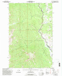
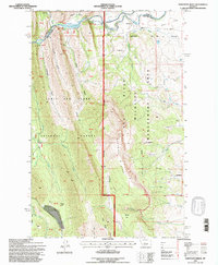
 1995 Mount Wright1997 Print · USGSThe Rocky Mountain Front in the mid-1990s comes alive in this survey of high-elevation forest and wilderness. Outdoor historians can trace the early layout of the Teton Pass Winter Sports Area and the rugged drainage of the Teton River near Mount Wright.
 - 1995 Map of Sawtooth Ridge, 1997 Print
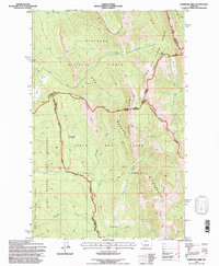
 1995 Sawtooth Ridge1997 Print · USGSThe Sun River canyon and the eastern edge of the Rockies come alive in the mid-1990s as the river flows from the national forest toward the plains. Researchers can trace land use through the Neal Ranch, Diversion Dam, and Sun Canyon Lodge.
 - 1995 Map of Walling Reef, 1997 Print
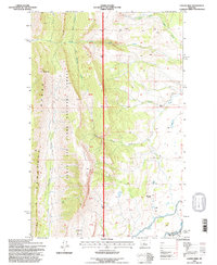
 1995 Walling Reef1997 Print · USGSTeton County’s high wilderness interior is captured in the mid-1990s, where the dramatic Walling Reef meets the vast Bob Marshall Wilderness. Trace rugged headwaters like the Teton River and find named landmarks like Old Man of the Hills.
 - 1995 Map of Our Lake, 1997 Print
 1995 Our Lake1997 Print · USGSHigh in the Rocky Mountains during the mid-1990s, this survey captures a landscape defined by the Continental Divide and vast wilderness areas. Researchers can trace historic access points like Route Creek Pass, the Bear Top Lookout, and the remote Our Lake.2 unique versions available
 - 1995 Map of Fish Lake, 1997 Print
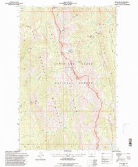
 1995 Fish Lake1997 Print · USGSThe Montana high country meets the Blackfeet Indian Reservation in the mid-nineties, where the plains give way to the Sawtooth Range. Trace the intersection of wilderness boundaries and early water engineering like Miller Ditch and Swift Reservoir.
 - 1995 Map of Volcano Reef, 1997 Print
 1995 Volcano Reef1997 Print · USGSThe eastern front of the Rockies meets the Montana plains in the 1990s, where protected wilderness borders industrial energy development. Researchers can trace the geological spine of Volcano Reef alongside active Gas Wells and the deep passage of Blackleaf Canyon.
 - 1995 Map of Ear Mountain, 1997 Print
 1995 Ear Mountain1997 Print · USGSTeton County's high country is captured here in the mid-1990s as the protected lands of the Lewis and Clark National Forest meet the plains. Researchers can locate the Ear Mountain Guard Station, the Gleason Resort, and the distinct bounds of the Pine Butte Swamp Nature Conservancy Preserve.
End of results
Showing maps 1-21 of 21
Top cities of Teton County
Frequently asked questions
- What are the different types of historical maps available for Teton County?
- What is the oldest map of Teton County?
- Where can I purchase historical maps of Teton County for my home or office?
- Where can I download high-res historical maps of Teton County?
- Are there historical topographic maps available for Teton County?
- Is there historical aerial imagery available for Teton County?
- Where are historical maps of Teton County sourced from?