1960s Maps of Teton County, Montana
Explore 19 historic maps of Teton County from the 1960s. These maps offer a rare glimpse into what life looked like during the 1960s — showing old roads, neighborhoods, homes, and landmarks that have changed or disappeared over time.
Whether you're researching your family's past, planning a metal detecting trip, or studying how Teton County's landscape evolved across the 1960s, these high-resolution maps are a powerful tool for exploring the history of this region.
- Focus on a specific era: All maps on this page are from the 1960s, giving you a focused view of this time period.
- See what’s changed: Compare century-old streets, trails, and buildings to today's modern landscape using overlays and satellite layers.
- Research with precision: Use these maps for genealogy, historical research, land use analysis, or educational projects.
- View, download, or print: Maps are fully viewable online in high resolution, and can be downloaded or printed for your own records.
Start exploring Teton County's history through authentic maps from the 1960s. This is your window into the past.
Teton County, MT maps
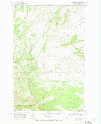
(19)- 1960 Map of Bynum, 1962 Print
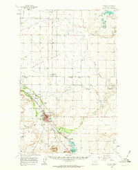
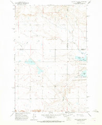
 1960 Bynum1962 Print · USGSThe Bynum area during the early 1960s was a hub of irrigation and rail-side ranching. Genealogists and historians can trace family holdings like Perkins Ranch, find the Tetonview Sch, and locate the Miller Colony north of Koyl.2 unique versions available
 - 1960 Map of Choteau, 1962 Print
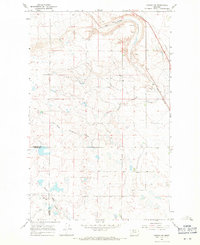
 1960 Choteau1962 Print · USGSMontana's Rocky Mountain Front is seen here in the early sixties, centered on the irrigation and rail networks around Choteau. Genealogists and local historians can trace rural school sites like East Farmington No 5 Sch or search for family roots at Trinity Cem and Agawam.2 unique versions available
 - 1960 Map of Gilman, 1963 Print
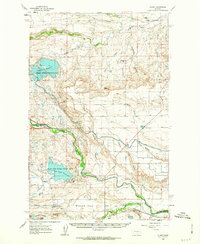 1960 Gilman1963 Print · USGSThe Sun River valley in the early sixties was a landscape of intensive irrigation and rail transport. Genealogists and historians can trace the Great Northern rail line through Gilman or locate family-held land near Burch Ranch and the Liberty Sch.2 unique versions available
 - 1960 Map of Freezeout Lake, 1963 Print
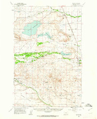
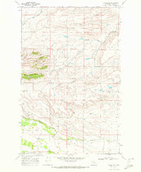
 1960 Freezeout Lake1963 Print · USGSThe Teton County plains are shown in the early sixties as a hub of irrigation and rail activity. Researchers can trace the water-management systems through Bole and Riebeling, or locate family landmarks like the Hamilton Ranch and School Section.2 unique versions available
 - 1960 Map of Cut Bank, 1968 Print
 1960 Cut Bank1968 Print · USGSThe high peaks of the Rockies meet the eastern plains in the 1960s, showing the intersection of federal lands and the Blackfeet Indian Reservation. Trace the path of the Great Northern railway and find local landmarks like the Blackfoot Boarding School and Family Mission Cem.3 unique versions available
 - 1962 Map of Choteau
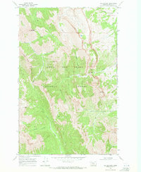
 1962 Choteau1962 Print · USGSThe Rocky Mountain Front meets the western plains in the early 1960s, showing a landscape defined by the Continental Divide. Genealogists and researchers can trace the tracks of the Great Northern and find settlements like Choteau, Augusta, and Bynum.
 - 1963 Map of Cut Bank
 1963 Cut Bank1963 Print · USGSNorthern Montana’s mountain passes and high plains are captured here in the early 1960s. Genealogists and historians can trace the Great Northern rail stops from Browning to Ethridge or locate the remote outposts at Polebridge and Babb.
 - 1964 Map of Cut Bank
 1964 Cut Bank1964 Print · USGSGlacier National Park and the Blackfeet Indian Reservation meet in the early sixties at the triple divide of North America. Researchers can trace the Great Northern Railway through mountain passes and locate local landmarks like the Blackfoot Boarding School and Apgar Village.
 - 1965 Map of Benton Lake West, 1967 Print
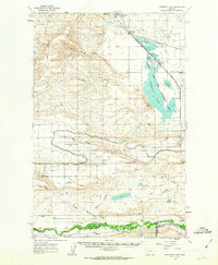
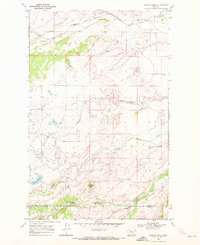
 1965 Benton Lake West1967 Print · USGSThe northern Montana prairie and the sprawling wetlands of the Benton Lake National Wildlife Refuge are captured here in the mid-1960s. Researchers can trace the boundaries of three counties and locate specific land-use markers like a Pipeline, Well, and Gravel Pit.2 unique versions available
 - 1967 Map of Conrad SW, 1971 Print
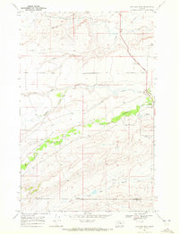
 1967 Conrad SW1971 Print · USGSThe Montana high plains in the late sixties reveal a landscape of seasonal drainages and essential rail links. You can trace the path of the Great Northern railroad and the winding South Pondera Coulee near the Eyraud Lakes.
 - 1968 Map of Swift Reservoir, 1971 Print
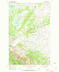
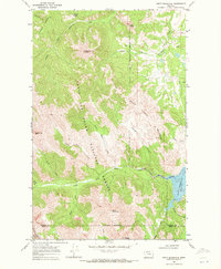 1968 Swift Reservoir1971 Print · USGSThe Montana Rocky Mountain Front meets the plains in the late 1960s, showing a land of massive peaks and critical water storage. Trace the Blackfeet Indian Reservation Boundary as it skirts Swift Reservoir and the heights of Feather Woman Mountain.2 unique versions available
 - 1968 Map of Gateway Pass, 1972 Print
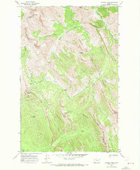 1968 Gateway Pass1972 Print · USGSThe high country of the Continental Divide in the late sixties is documented here, showing the intersection of two national forests. Researchers can trace the rugged Gateway Trail past Gateway Cabin to the Gateway Pass and the remote Bob Marshall Wilderness.2 unique versions available
 - 1968 Map of Fish Lake, 1972 Print
 1968 Fish Lake1972 Print · USGSPondera County at the edge of the Rockies in the late 1960s shows a rugged landscape defined by the Blackfeet Indian Reservation boundary. Genealogists and researchers can trace the location of the Fish Lake Sch and industrial sites like the Swift Dam and Gravel Pit.
 - 1968 Map of Morningstar Mountain, 1972 Print
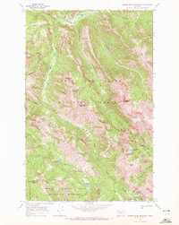 1968 Morningstar Mountain1972 Print · USGSThe high peaks of the northern Rockies are surveyed here in the late sixties, where the Continental Divide splits two national forests. Trace the remote routes through Muskrat Pass and Badger Pass or locate alpine waters like Emerald Lake and Blue Lake.3 unique versions available
 - 1968 Map of Dupuyer West, 1972 Print
 1968 Dupuyer West1972 Print · USGSThe high Montana prairie meets the foothills of the Rockies in the late sixties, showing a landscape defined by ranching and historic routes. Trace the path of the Lewis and Clark Trail and locate family landmarks such as Dupuyer Cem and Dupuyer.
 - 1968 Map of Scoffin Butte, 1972 Print
 1968 Scoffin Butte1972 Print · USGSThe northern Montana plains meet the reservation border in the late sixties, a landscape defined by ranching and wide-open rangeland. Genealogists can locate the rural Terryahn School and trace water rights along Birch Creek and the Tedson Reservoir.2 unique versions available
 - 1968 Map of Volcano Reef, 1972 Print
 1968 Volcano Reef1972 Print · USGSTeton County, Montana, was a landscape of deep coulees and mountain reefs in the late 1960s. Researchers can trace resource exploration sites like a Gas Well and navigate rugged terrain via the Pack Trail near Blackleaf Canyon.
 - 1968 Map of Blackleaf, 1972 Print
 1968 Blackleaf1972 Print · USGSThe Teton County foothills in the late sixties reveal a landscape of deep coulees and mountain-fed streams near the Front Range. Researchers can trace the small settlement at Blackleaf and follow the winding courses of Blackleaf Creek and the Marias River.
 - 1968 Map of Walling Reef, 1972 Print
 1968 Walling Reef1972 Print · USGSTeton County’s high mountain front is captured in the late sixties, showing the transition from forest wilderness to the eastern plains. Researchers can trace the complex drainages of North Fork Teton River and landmarks like Walling Reef and Bum Shot Mountain.
End of results
Showing maps 1-19 of 19
Top cities of Teton County
Frequently asked questions
- What are the different types of historical maps available for Teton County?
- What is the oldest map of Teton County?
- Where can I purchase historical maps of Teton County for my home or office?
- Where can I download high-res historical maps of Teton County?
- Are there historical topographic maps available for Teton County?
- Is there historical aerial imagery available for Teton County?
- Where are historical maps of Teton County sourced from?