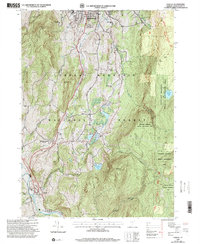
1997 Map of Pownal
USGS Topo · Published 2000About this map
The Green Mountain National Forest dominates the landscape south of Bennington, where the terrain transitions from the hospital and residential outskirts of the city into a complex network of peaks and upland ponds. The rugged geography is defined by high points like Mount Anthony and The Dome, while the lowlands are drained by the Hoosic River and its various tributaries. This 1997 revision of a 1954 survey captures the persistence of small rural schoolhouses and cemeteries in the hills, including the Oak Hill Sch and the Towsley Cem, providing a clear record of family names and early local education sites.
Find a feature on this map
45 named features on this map. Tap any name to fly to it.
Don’t see what you’re looking for? This feature index may not catch every label — zoom into the map to look around manually.
Map Details
Editions of this 1997 Pownal Map
This is the sole edition of this map. No revisions or reprints were ever made.
Other maps of this area

1886 · Greylock
USGS Topo · 1:62,500

1888 · Berlin
USGS Topo · 1:62,500

1890 · Berlin
USGS Topo · 1:62,500

1891 · Greylock
USGS Topo · 1:62,500

1893 · Greylock
USGS Topo · 1:62,500

1894 · Berlin
USGS Topo · 1:62,500

1897 · Hoosick
USGS Topo · 1:62,500

1898 · Berlin
USGS Topo · 1:62,500

1898 · Bennington
USGS Topo · 1:62,500

1898 · Greylock
USGS Topo · 1:62,500