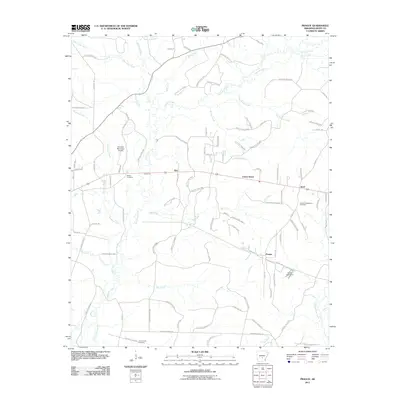
2011 Map of Prague
USGS Topo · Published 2011About this map
Hurricane Creek and its many tributaries, including White Oak Creek and Simpson Creek, define the drainage patterns across this section of Grant County. This early 21st-century landscape is marked by a complex network of timber management routes, such as Forestry Road 9722 and Forestry Road 9813, which crisscross the terrain between small rural communities. Small settlements like Ebb, Center Grove, and Prague anchor the local road system, while the Sheridan Municipal Airport serves as a modern transportation hub in the northwest. For those researching local family history, the map identifies several burial grounds including Hardin Cemetery and Center Campground Cemetery. The eastern edge is defined by the winding course of Derrieusseaux Creek, and the Horne Lake Dam signifies managed water resources within this primarily wooded and agricultural region.
Find a feature on this map
106 named features on this map. Tap any name to fly to it.
Don’t see what you’re looking for? This feature index may not catch every label — zoom into the map to look around manually.
Map Details
Editions of this 2011 Prague Map
This is the sole edition of this map. No revisions or reprints were ever made.
Other maps of this area

1932 · Pastoria
USGS Topo · 1:62,500

1935 · Pastoria
USGS Topo · 1:62,500

1955 · Little Rock
USGS Topo · 1:250,000

1956 · Little Rock
USGS Topo · 1:250,000

1960 · Little Rock
USGS Topo · 1:250,000

1962 · Pine Bluff NW
USGS Topo · 1:24,000

1964 · Little Rock
USGS Topo · 1:250,000

1964 · Sheridan
USGS Topo · 1:24,000

1964 · Cane Creek
USGS Topo · 1:24,000

1964 · Belfast
USGS Topo · 1:24,000