2022 Map of Prairie du Chien
USGS Topo · Published 2022About this map
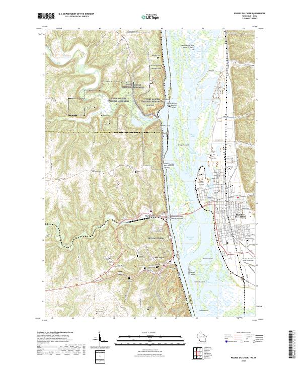
Effigy Mounds National Monument overlooks the confluence of the Yellow River and the Mississippi River, where the borders of Iowa and Wisconsin meet. This modern survey details the significant cultural and natural landscape of Prairie du Chien, one of the region's oldest European settlements. The map highlights the town's civic heart, including the Crawford County Courthouse and the historical site of Fort Crawford. Across the water, the steep bluffs of the Iowa side harbor the riverfront communities of McGregor and Marquette, connected by the bridge spanning the river's East Channel.
Find a feature on this map
89 named features on this map. Tap any name to fly to it.
Don’t see what you’re looking for? This feature index may not catch every label — zoom into the map to look around manually.
Map Details
Editions of this 2022 Prairie du Chien Map
This is the sole edition of this map. No revisions or reprints were ever made.
Historical Maps of Prairie du Chien Through Time
1 maps found