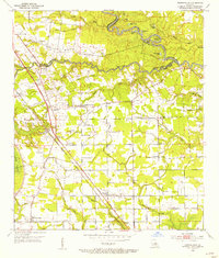
1953 Map of Prairieville
USGS Topo · Published 1954About this map
Amite River meanders along the border of East Baton Rouge and Livingston Parishes, defining a landscape of oxbow lakes and wetlands like Horseshoe Lake and Melton Lake. In the early 1950s, the southern portion of this region in Ascension Parish shows a maturing network of rural settlements and agricultural centers. The Airline Highway and the Kansas City Southern railroad form a clear industrial and transport spine through the heart of the area, connecting established communities such as Prairieville, Duplessis, and Dutch Town.
Find a feature on this map
60 named features on this map. Tap any name to fly to it.
Don’t see what you’re looking for? This feature index may not catch every label — zoom into the map to look around manually.
Map Details
Editions of this 1953 Prairieville Map
This is the sole edition of this map. No revisions or reprints were ever made.
Other maps of this area

1892 · Donaldsonville
USGS Topo · 1:62,500

1908 · Baton Rouge
USGS Topo · 1:62,500

1934 · Denham Springs
USGS Topo · 1:62,500

1935 · Gonzales
USGS Topo · 1:31,680

1936 · White Castle
USGS Topo · 1:62,500

1939 · Denham Springs
USGS Topo · 1:62,500

1939 · Baton Rouge
USGS Topo · 1:62,500

1939 · Donaldsonville
USGS Topo · 1:62,500

1947 · Sorrento
USGS Topo · 1:31,680

1953 · Walker
USGS Topo · 1:24,000