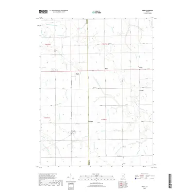
2019 Map of Preble
USGS Topo · Published 2019About this map
The agricultural divide of the Wells and Adams County line defines this portion of the Indiana heartland, where a dense network of drainage ditches supports the region's productive farmland. Small communities such as Tocsin, Preble, and Craigville are connected by a grid of rural roads, including State Road 301. The map reveals a high concentration of local history markers, from the Prairie View and Salem cemeteries to the smaller hamlets of Magley and Honduras. Water management is the dominant landscape feature, with complex systems like Eightmile Number Two, Werling-Myers, and Holthouse crisscrossing the terrain. Evidence of local aviation is seen at The Lazy K Airport, while the headwaters of Nickelsen Creek and Eightmile Creek drain the low-lying prairie into the surrounding watershed.
Find a feature on this map
77 named features on this map. Tap any name to fly to it.
Don’t see what you’re looking for? This feature index may not catch every label — zoom into the map to look around manually.
Map Details
Editions of this 2019 Preble Map
This is the sole edition of this map. No revisions or reprints were ever made.
Other maps of this area

1911 · Berne
USGS Topo · 1:48,000

1953 · Muncie
USGS Topo · 1:250,000

1956 · Muncie
USGS Topo · 1:250,000

1961 · Hoagland
USGS Topo · 1:24,000

1962 · Poe
USGS Topo · 1:24,000

1962 · Uniondale
USGS Topo · 1:24,000

1962 · Ossian
USGS Topo · 1:24,000

1962 · Preble
USGS Topo · 1:24,000

1962 · Berne
USGS Topo · 1:24,000
1962 · Decatur
USGS Topo · 1:24,000