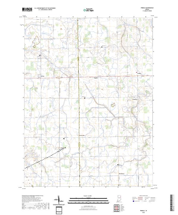
2022 Map of Preble
USGS Topo · Published 2022About this map
Agricultural lands along the border of Wells and Adams counties define this survey, where the township grid is deeply etched by an extensive network of drainage infrastructure. This drainage system, including the Eightmile Number Two Ditch and the Werling Joint Ditch, reflects the engineering required to maintain the productivity of the northern Indiana plains. Small clusters of settlement like Preble, Magley, and Peterson are situated along the east-west corridor, while Craigville and Curryville anchor the southern portion of the map.
Find a feature on this map
44 named features on this map. Tap any name to fly to it.
Don’t see what you’re looking for? This feature index may not catch every label — zoom into the map to look around manually.
Map Details
Editions of this 2022 Preble Map
This is the sole edition of this map. No revisions or reprints were ever made.
Other maps of this area

1911 · Berne
USGS Topo · 1:48,000

1953 · Muncie
USGS Topo · 1:250,000

1956 · Muncie
USGS Topo · 1:250,000

1961 · Hoagland
USGS Topo · 1:24,000

1962 · Poe
USGS Topo · 1:24,000

1962 · Uniondale
USGS Topo · 1:24,000

1962 · Ossian
USGS Topo · 1:24,000

1962 · Preble
USGS Topo · 1:24,000

1962 · Berne
USGS Topo · 1:24,000
1962 · Decatur
USGS Topo · 1:24,000