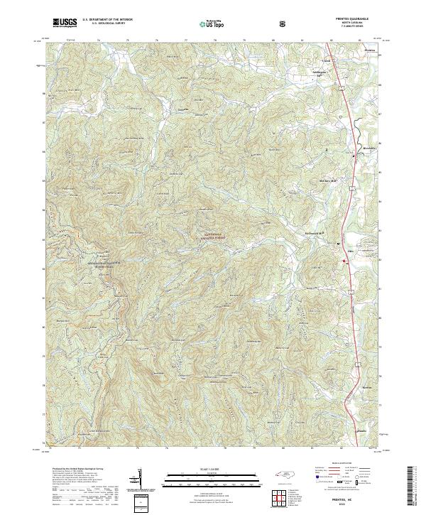
2022 Map of Prentiss
USGS Topo · Published 2022About this map
The Little Tennessee River corridor defines this portion of the Nantahala National Forest, where historical mountain settlements and industrial sites are documented along the river's path. Several family and community mills, including Addington Mill, McClure Mill, and McDonald Mill, are situated along the eastern valley floor, signifying the local importance of water-powered milling in these high-altitude communities. The landscape transitions from the river valley to the heights of the Blue Ridge Mountains, where the Appalachian National Scenic Trail traverses prominent peaks like Albert Mtn and Pinnacle Mtn. Genealogists may find value in the locations of Rush Cem and Asbury Cem, which serve as markers for early families in settlements like Otto and Riverside. This map provides a clear look at the network of old mountain roads and forest trails that linked these isolated coves and ridges.
Find a feature on this map
146 named features on this map. Tap any name to fly to it.
Don’t see what you’re looking for? This feature index may not catch every label — zoom into the map to look around manually.
Map Details
Editions of this 2022 Prentiss Map
This is the sole edition of this map. No revisions or reprints were ever made.
Other maps of this area

1886 · Dahlonega
USGS Topo · 1:125,000

1886 · Walhalla
USGS Topo · 1:125,000

1891 · Cowee
USGS Topo · 1:125,000

1892 · Dahlonega
USGS Topo · 1:125,000

1892 · Walhalla
USGS Topo · 1:125,000

1896 · Walhalla
USGS Topo · 1:125,000

1896 · Dahlonega
USGS Topo · 1:125,000

1897 · Cowee
USGS Topo · 1:125,000

1903 · Dahlonega
USGS Topo · 1:125,000

1907 · Cowee
USGS Topo · 1:125,000