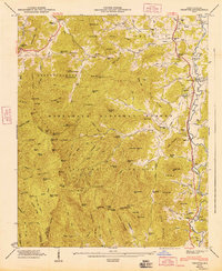
1947 Map of Prentiss
USGS Topo · Published 1947About this map
The Little River and Tennessee River valleys in Macon County serve as the primary corridors for settlement and industry in the late 1940s. A series of water-powered sites, including Addington Mill, McClure Mill, and McDonald Mill, are situated along the eastern drainage, reflecting the agrarian economy of the era. The presence of the Coweeta Experiment Station highlights the importance of forestry research within the Nantahala National Forest.
Find a feature on this map
156 named features on this map. Tap any name to fly to it.
Don’t see what you’re looking for? This feature index may not catch every label — zoom into the map to look around manually.
Map Details
Editions of this 1947 Prentiss Map
This is the sole edition of this map. No revisions or reprints were ever made.
Other maps of this area

1886 · Dahlonega
USGS Topo · 1:125,000

1886 · Walhalla
USGS Topo · 1:125,000

1891 · Cowee
USGS Topo · 1:125,000

1892 · Dahlonega
USGS Topo · 1:125,000

1892 · Walhalla
USGS Topo · 1:125,000

1896 · Walhalla
USGS Topo · 1:125,000

1896 · Dahlonega
USGS Topo · 1:125,000

1897 · Cowee
USGS Topo · 1:125,000

1903 · Dahlonega
USGS Topo · 1:125,000

1907 · Cowee
USGS Topo · 1:125,000