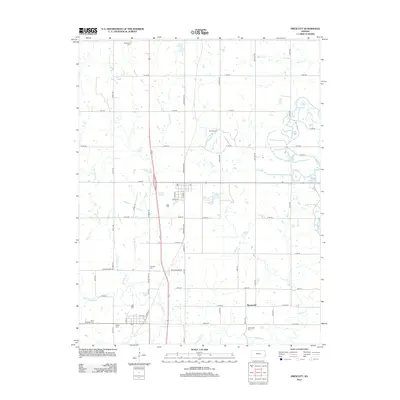
2012 Map of Prescott
USGS Topo · Published 2012About this map
Prescott and the smaller settlement of Barnesville anchor this corner of Linn County, where the landscape is defined by the winding course of the Little Osage River and its numerous tributaries. The map reveals a dense concentration of burial grounds, including the Battlefield Cem to the north and Saint Michaels Cem to the southwest, suggesting a landscape layered with local heritage. Water management and drainage are central themes here, evidenced by the central Prescott City Lake and the convergence of E Laberdie Cr, W Laberdie Cr, and Indian Cr. The transportation network relies on a transition from the modern path of Us HWY 69 to older rural thoroughfares like Old US Hwy 69, illustrating the evolution of regional transit routes through the Kansas countryside.
Find a feature on this map
55 named features on this map. Tap any name to fly to it.
Don’t see what you’re looking for? This feature index may not catch every label — zoom into the map to look around manually.
Map Details
Editions of this 2012 Prescott Map
This is the sole edition of this map. No revisions or reprints were ever made.
Other maps of this area

1884 · Fort Scott
USGS Topo · 1:125,000

1886 · Fort Scott
USGS Topo · 1:125,000

1887 · Mound City
USGS Topo · 1:125,000

1893 · Fort Scott
USGS Topo · 1:125,000

1893 · Mound City
USGS Topo · 1:125,000

1938 · Worland
USGS Topo · 1:24,000

1940 · Worland
USGS Topo · 1:24,000

1940 · Hume
USGS Topo · 1:24,000

1942 · Hume
USGS Topo · 1:24,000

1942 · Richards
USGS Topo · 1:24,000