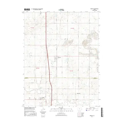
2015 Map of Prescott
USGS Topo · Published 2015About this map
Prescott stands as the primary settlement in this part of eastern Kansas, situated along the corridor defined by Old US Hwy 69. The landscape transitions from the upland drainage of Walnut Cr and Indian Cr in the north toward the southern river valley. The border between Linn Co and Bourbon Co bisects the area, marked by a shift in the road grid at Zink Rd. This 2015 survey reveals a significant concentration of local heritage sites, including Battlefield Cem and Fairview Cem, which reflect the long-standing agricultural communities of the region. To the south, the village of Barnesville and its associated Barnesville Cem sit near the winding course of the Little Osage River, while the town of Fulton marks the southwestern extent of the map, characterized by its own distinct street grid including W Cedar St and W Osage St.
Find a feature on this map
39 named features on this map. Tap any name to fly to it.
Don’t see what you’re looking for? This feature index may not catch every label — zoom into the map to look around manually.
Map Details
Editions of this 2015 Prescott Map
This is the sole edition of this map. No revisions or reprints were ever made.
Other maps of this area

1884 · Fort Scott
USGS Topo · 1:125,000

1886 · Fort Scott
USGS Topo · 1:125,000

1887 · Mound City
USGS Topo · 1:125,000

1893 · Fort Scott
USGS Topo · 1:125,000

1893 · Mound City
USGS Topo · 1:125,000

1938 · Worland
USGS Topo · 1:24,000

1940 · Worland
USGS Topo · 1:24,000

1940 · Hume
USGS Topo · 1:24,000

1942 · Hume
USGS Topo · 1:24,000

1942 · Richards
USGS Topo · 1:24,000