
1958 Map of Presque Isle
USGS Topo · Published 1958About this map
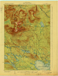
Presque Isle AFB serves as a Cold War anchor for the eastern edge of this Maine landscape, providing a sharp contrast to the dense network of rivers and timberlands to the west. The area is defined by its complex hydrology, where the Allagash River and St John River flow through a succession of major water bodies like Chamberlain Lake, Eagle Lake, and Umsaskis Lake. These waterways were the primary arteries for the region’s logging history, long before more permanent settlements were established.
Find a feature on this map
51 named features on this map. Tap any name to fly to it.
Don’t see what you’re looking for? This feature index may not catch every label — zoom into the map to look around manually.
Map Details
Editions of this 1958 Presque Isle Map
This is the sole edition of this map. No revisions or reprints were ever made.
Other maps of this area

1921 · Van Buren
USGS Topo · 1:250,000

1927 · Stockholm
USGS Topo · 1:48,000

1927 · Katahdin
USGS Topo · 1:48,000

1927 · Square Lake
USGS Topo · 1:48,000

1928 · Eagle Lake
USGS Topo · 1:48,000

1928 · Winterville
USGS Topo · 1:48,000

1929 · Portage
USGS Topo · 1:62,500

1929 · Caribou
USGS Topo · 1:48,000
1930 · Katahdin
USGS Topo · 1:62,500

1930 · Greenlaw
USGS Topo · 1:48,000