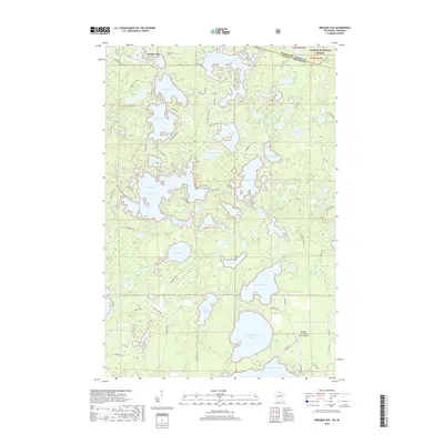
2018 Map of Presque Isle
USGS Topo · Published 2018About this map
The settlement of Presque Isle sits at the northern edge of this Northwoods landscape, where the Wisconsin-Michigan state line divides the lake-dotted terrain of Vilas and Gogebic counties. This 2018 survey documents a region defined by its dense glacial hydrology, where large water bodies like Crab Lake and Big Crooked Lake are connected by smaller systems such as Rice Creek and Wildcat Creek. The northern portion transition into the Ottawa National Forest, while the southern reaches center around the aviation and tourism hub of the Boulder Junction Payzer Airport.
Find a feature on this map
96 named features on this map. Tap any name to fly to it.
Don’t see what you’re looking for? This feature index may not catch every label — zoom into the map to look around manually.
Map Details
Editions of this 2018 Presque Isle Map
This is the sole edition of this map. No revisions or reprints were ever made.
Other maps of this area

1939 · Trout Lake
USGS Topo · 1:48,000

1939 · Winchester
USGS Topo · 1:48,000

1946 · Winchester
USGS Topo · 1:48,000

1946 · Trout Lake
USGS Topo · 1:48,000

1949 · Trout Lake
USGS Topo · 1:48,000

1955 · Marenisco
USGS Topo · 1:62,500

1955 · Boulder Junction
USGS Topo · 1:62,500

1955 · Winchester
USGS Topo · 1:62,500

1955 · Wakefield
USGS Topo · 1:62,500

1958 · Iron River
USGS Topo · 1:250,000