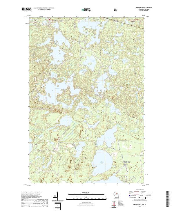
2022 Map of Presque Isle
USGS Topo · Published 2022About this map
Presque Isle sits at the northern edge of a dense glacial lake district along the border of Vilas County, Wisconsin, and the Michigan state line. This landscape is defined by an intricate network of water bodies, ranging from the large Big Crooked Lake and Armour Lake to the uniquely named Hells Kitchen Lake and Little Crab Lake. The density of these lakes suggests a terrain shaped by receding glaciers, leaving behind kettle lakes and basins that have become the focal point for regional recreation and conservation.
Find a feature on this map
105 named features on this map. Tap any name to fly to it.
Don’t see what you’re looking for? This feature index may not catch every label — zoom into the map to look around manually.
Map Details
Editions of this 2022 Presque Isle Map
This is the sole edition of this map. No revisions or reprints were ever made.
Other maps of this area

1939 · Trout Lake
USGS Topo · 1:48,000

1939 · Winchester
USGS Topo · 1:48,000

1946 · Winchester
USGS Topo · 1:48,000

1946 · Trout Lake
USGS Topo · 1:48,000

1949 · Trout Lake
USGS Topo · 1:48,000

1955 · Marenisco
USGS Topo · 1:62,500

1955 · Boulder Junction
USGS Topo · 1:62,500

1955 · Winchester
USGS Topo · 1:62,500

1955 · Wakefield
USGS Topo · 1:62,500

1958 · Iron River
USGS Topo · 1:250,000