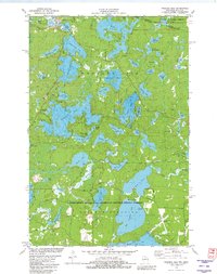
1981 Map of Presque Isle
USGS Topo · Published 1982About this map
The Michigan-Wisconsin borderlands of Vilas County are defined here by a dense labyrinth of glacial lakes and protected woodlands. The small community of Presque Isle sits at the northern edge, where the Presque Isle River begins its course amidst a cluster of waters including Little Horsehead Lake and Oxbow Lake. Much of the southern landscape is contained within the Northern Highland-American Legion State Forest, reflecting a region dedicated to conservation and recreation by the early 1980s. Notable recreational landmarks like the Dairymens Country Club and the Boulder Junction Airport suggest the area's established role as a seasonal retreat. The map documents an intricate shoreline system, particularly around the sprawling reaches of Crab Lake and North Crab Lake, interspersed with isolated features like a Lookout Tower and a Gravel Pit that mark the intersection of natural resource management and local infrastructure.
Find a feature on this map
67 named features on this map. Tap any name to fly to it.
Don’t see what you’re looking for? This feature index may not catch every label — zoom into the map to look around manually.
Map Details
Editions of this 1981 Presque Isle Map
This is the sole edition of this map. No revisions or reprints were ever made.
Other maps of this area

1939 · Trout Lake
USGS Topo · 1:48,000

1939 · Winchester
USGS Topo · 1:48,000

1946 · Winchester
USGS Topo · 1:48,000

1946 · Trout Lake
USGS Topo · 1:48,000

1949 · Trout Lake
USGS Topo · 1:48,000

1955 · Marenisco
USGS Topo · 1:62,500

1955 · Boulder Junction
USGS Topo · 1:62,500

1955 · Winchester
USGS Topo · 1:62,500

1955 · Wakefield
USGS Topo · 1:62,500

1958 · Iron River
USGS Topo · 1:250,000