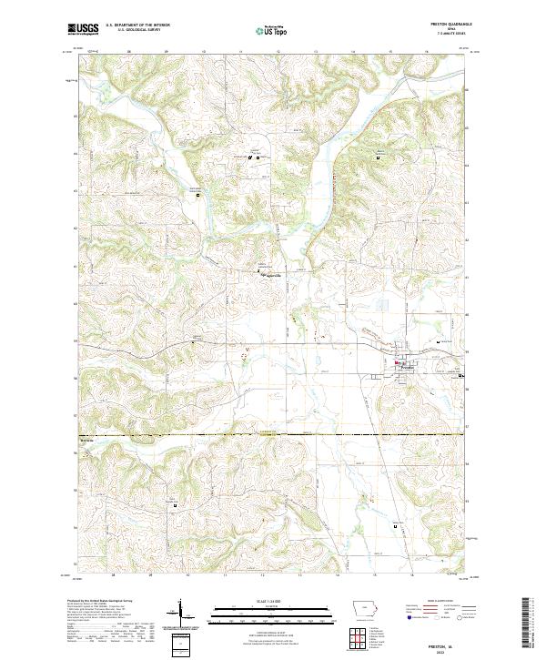
2022 Map of Preston
USGS Topo · Published 2022About this map
Preston serves as a primary hub of activity in this section of eastern Iowa, situated where several creeks converge before joining the broader drainage systems. The town’s layout is punctuated by Preston Cem and Saint Josephs Cem, which anchor the eastern edge of the community. To the northwest, the Maquoketa River meanders through a deeply carved valley, creating a distinct topographical contrast to the more level agricultural uplands. The rural landscape is notably characterized by a high density of family-named burial sites, such as Schmidt Farm Cem, Russell Farm Cem, and Reed Cem, suggesting a long-standing history of family land ownership and homesteading in the area.
Find a feature on this map
73 named features on this map. Tap any name to fly to it.
Don’t see what you’re looking for? This feature index may not catch every label — zoom into the map to look around manually.
Map Details
Editions of this 2022 Preston Map
This is the sole edition of this map. No revisions or reprints were ever made.
Other maps of this area

1891 · DeWitt
USGS Topo · 1:62,500

1891 · Maquoketa
USGS Topo · 1:62,500

1892 · Goose Lake
USGS Topo · 1:62,500

1894 · Goose Lake
USGS Topo · 1:62,500

1899 · Clinton
USGS Topo · 1:125,000

1901 · Peosta
USGS Topo · 1:125,000

1901 · Rock Island
USGS Topo · 1:125,000

1910 · Rock Island
USGS Topo · 1:125,000

1935 · Miles
USGS Topo · 1:62,500

1941 · Miles
USGS Topo · 1:62,500