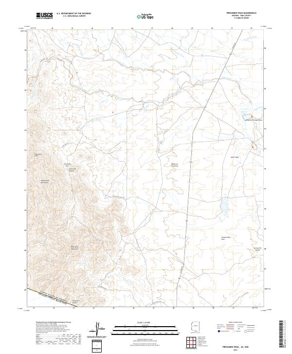
2021 Map of Presumido Peak
USGS Topo · Published 2021About this map
Presumido Peak and the surrounding Baboquivari Mountains dominate this high-desert landscape along the international border between the United States and Mexico. The terrain is defined by a series of dramatic geographic transitions, from the narrow confines of Presumido Canyon to the broad expanse of the Altar Valley in the east. Numerous desert drainages, including Gallineta Wash, Cuadro Wash, and Bailey Wash, create a complex network of seasonal watercourses that shape the topography.
Find a feature on this map
33 named features on this map. Tap any name to fly to it.
Don’t see what you’re looking for? This feature index may not catch every label — zoom into the map to look around manually.
Map Details
Editions of this 2021 Presumido Peak Map
This is the sole edition of this map. No revisions or reprints were ever made.
Other maps of this area

1920 · Arivaca
USGS Topo · 1:125,000

1921 · Old Glory
USGS Topo · 1:125,000

1941 · Presumido Peak
USGS Topo · 1:62,500

1941 · Arivaca
USGS Topo · 1:62,500

1942 · Oro Blanco
USGS Topo · 1:62,500

1943 · Fresnal
USGS Topo · 1:125,000

1943 · Arivaca
USGS Topo · 1:62,500

1943 · Old Glory
USGS Topo · 1:125,000

1943 · Presumido Peak
USGS Topo · 1:62,500

1944 · Oro Blanco
USGS Topo · 1:62,500