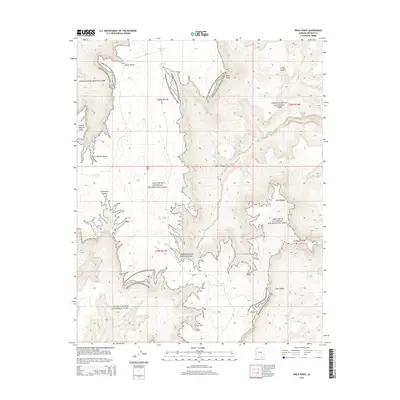
2014 Map of Price Point
USGS Topo · Published 2014About this map
Price Point serves as a prominent overlook in this high-desert landscape where the borders of Grand Canyon National Park and the Lake Mead National Recreation Area meet. The terrain is defined by a series of deep drainage systems, most notably Two Hundred and Ninemile Canyon and Separation Canyon, which cut through the high plateau towards the Colorado River corridor. Man-made water catchments like Shigley Tank, Rodger Tank, and Kelly Tanks dot the map, indicating the vital importance of water management for ranching or wildlife in this arid region of Mohave County. Significant landmarks such as Blue Mtn and Fall Canyon provide navigational anchors across a landscape that remains largely inaccessible except by primitive routes like Az-67.
Find a feature on this map
23 named features on this map. Tap any name to fly to it.
Don’t see what you’re looking for? This feature index may not catch every label — zoom into the map to look around manually.
Map Details
Editions of this 2014 Price Point Map
This is the sole edition of this map. No revisions or reprints were ever made.
Other maps of this area

1886 · Diamond Creek
USGS Topo · 1:250,000

1886 · Mt. Trumbull
USGS Topo · 1:250,000

1892 · Diamond Creek
USGS Topo · 1:250,000

1892 · Mt. Trumbull
USGS Topo · 1:250,000

1948 · Williams
USGS Topo · 1:250,000

1953 · Grand Canyon
USGS Topo · 1:250,000

1954 · Williams
USGS Topo · 1:250,000

1956 · Williams
USGS Topo · 1:250,000

1957 · Grand Canyon
USGS Topo · 1:250,000

1958 · Grand Canyon
USGS Topo · 1:250,000