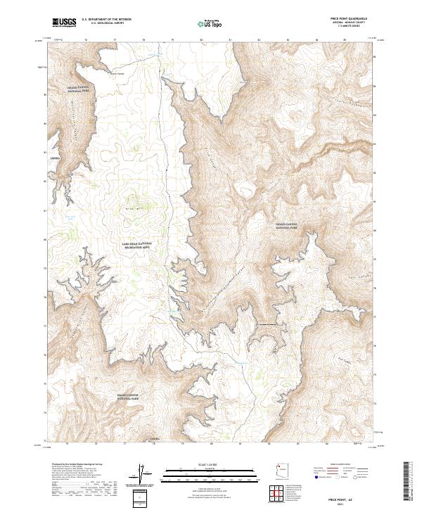
2021 Map of Price Point
USGS Topo · Published 2021About this map
Price Point commands the skyline in this high-desert portion of the Arizona Strip, where the plateaus are defined by dramatic vertical relief and sparse water resources. The terrain is characterized by the complex drainage systems of Price Canyon and the winding Two Hundred and Ninemile Canyon, which carve through the landscape toward the Colorado River corridor. This area represents a significant intersection of federal land management, where the boundaries of Grand Canyon National Park and the Lake Mead National Recreation Area meet.
Find a feature on this map
22 named features on this map. Tap any name to fly to it.
Don’t see what you’re looking for? This feature index may not catch every label — zoom into the map to look around manually.
Map Details
Editions of this 2021 Price Point Map
This is the sole edition of this map. No revisions or reprints were ever made.
Other maps of this area

1886 · Diamond Creek
USGS Topo · 1:250,000

1886 · Mt. Trumbull
USGS Topo · 1:250,000

1892 · Diamond Creek
USGS Topo · 1:250,000

1892 · Mt. Trumbull
USGS Topo · 1:250,000

1948 · Williams
USGS Topo · 1:250,000

1953 · Grand Canyon
USGS Topo · 1:250,000

1954 · Williams
USGS Topo · 1:250,000

1956 · Williams
USGS Topo · 1:250,000

1957 · Grand Canyon
USGS Topo · 1:250,000

1958 · Grand Canyon
USGS Topo · 1:250,000