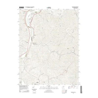
2014 Map of Prichard
USGS Topo · Published 2014About this map
The Big Sandy River forms a sharp geographical boundary between Kentucky and West Virginia, anchoring a landscape where rail lines and river valleys dictated the placement of long-standing communities. At the southern bend, Fort Gay and Louisa sit at the confluence of major forks, serving as historical hubs for the surrounding river-fed valleys. To the north, the village of Prichard is situated along the riverbank, surrounded by a dense network of family-named cemeteries such as the Shannon Cem, Christian Cem, and Big Sandy River Cem. The map reveals a deeply etched topography where creeks like Tabor Cr and Hurricane Cr cut through the ridges, providing the primary routes for local roads and early settlements like Hubbardstown and Zelda. This 2014 survey documents the enduring layout of rural homesteads and burial grounds, such as the Billups Gap Cem and Lakin Cem, that mark the genealogy of Wayne, Lawrence, and Boyd counties.
Find a feature on this map
95 named features on this map. Tap any name to fly to it.
Don’t see what you’re looking for? This feature index may not catch every label — zoom into the map to look around manually.
Map Details
Editions of this 2014 Prichard Map
This is the sole edition of this map. No revisions or reprints were ever made.
Other maps of this area

1892 · Huntington
USGS Topo · 1:125,000

1898 · Huntington
USGS Topo · 1:125,000

1901 · Guyandot
USGS Topo · 1:62,500

1901 · Ceredo
USGS Topo · 1:62,500

1902 · Guyandot
USGS Topo · 1:62,500

1903 · Kenova
USGS Topo · 1:125,000

1904 · Kenova
USGS Topo · 1:125,000

1909 · Wayne
USGS Topo · 1:62,500

1911 · Louisa
USGS Topo · 1:48,000

1913 · Ceredo
USGS Topo · 1:62,500