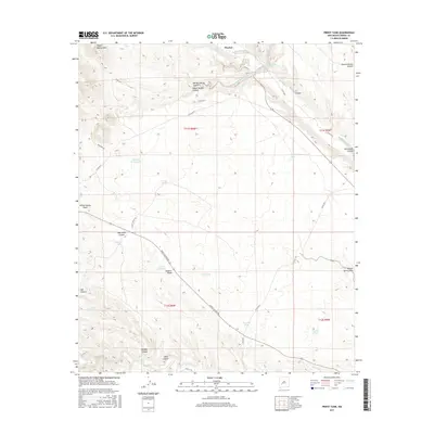
2017 Map of Priest Tank
USGS Topo · Published 2017About this map
Alamosa Creek and Cuchillo Negro Cr define the drainage patterns of this Sierra County landscape, where the high point of Roque Ramos Peak stands in the northwest. This arid terrain is marked by a sophisticated network of water catchment systems essential for ranching, including the namesake Priest Tank, Frank Tank, and Ignacio Pares Tank. The geography is deeply etched by numerous drainages such as Monticello Canyon, Bernal Chavez Canyon, and Old Mill Canyon, reflecting a long history of land use centered on these intermittent water sources. A series of county roads, including Punch Tucker Rd and Co Rd C017, provide the primary access through the canyons and draws that crisscross the quadrangle.
Find a feature on this map
38 named features on this map. Tap any name to fly to it.
Don’t see what you’re looking for? This feature index may not catch every label — zoom into the map to look around manually.
Map Details
Editions of this 2017 Priest Tank Map
This is the sole edition of this map. No revisions or reprints were ever made.
Other maps of this area

1954 · Tularosa
USGS Topo · 1:250,000

1958 · Tularosa
USGS Topo · 1:250,000

1961 · Priest Tank
USGS Topo · 1:24,000

1961 · Huerfano Hill
USGS Topo · 1:24,000

1961 · Sierra Fijardo
USGS Topo · 1:24,000

1961 · Williamsburg NW
USGS Topo · 1:24,000

1961 · Monticello
USGS Topo · 1:24,000

1961 · Cuchillo
USGS Topo · 1:24,000

1963 · Thumb Tank Peak
USGS Topo · 1:24,000

1965 · Jaralosa Mountain
USGS Topo · 1:24,000