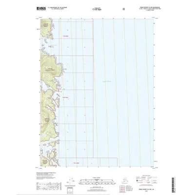
2018 Map of Prince Rupert D-6 NW
USGS Topo · Published 2018About this map
Tongass National Forest dominates the rugged western coastline of this Alaskan quadrangle, where the temperate rainforest meets the open Pacific Ocean. The coastline is deeply indented by sheltered waters such as Ingraham Bay and the aptly named Hidden Bay, which provided natural harbors along this maritime frontier. Prominent landmarks like Ingraham Point and Scott Point serve as navigational markers for the coastal waters of the Prince of Wales-Hyder Census Area. This 2018 survey detail provides a modern look at the protected wilderness boundaries within t79s r89e, t80s r89e, and t81s r90e, documenting the intersection of federal forest lands and the maritime environment of the Alexander Archipelago.
Find a feature on this map
9 named features on this map. Tap any name to fly to it.
Don’t see what you’re looking for? This feature index may not catch every label — zoom into the map to look around manually.
Map Details
Editions of this 2018 Prince Rupert D-6 NW Map
This is the sole edition of this map. No revisions or reprints were ever made.
Other maps of this area

1948 · Prince Rupert D-6
USGS Topo · 1:63,360

1948 · Ketchikan A-6
USGS Topo · 1:63,360

1948 · Craig A-1
USGS Topo · 1:63,360

1948 · Dixon Entrance D-1
USGS Topo · 1:63,360

1951 · Prince Rupert
USGS Topo · 1:250,000

1951 · Dixon Entrance
USGS Topo · 1:250,000

1951 · Prince Rupert D-6
USGS Topo · 1:63,360

1952 · Ketchikan
USGS Topo · 1:250,000

1955 · Ketchikan
USGS Topo · 1:250,000

1957 · Craig
USGS Topo · 1:250,000