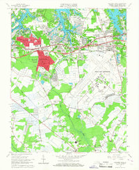
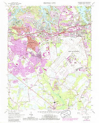
1965 Map of Princess Anne
USGS Topo · Published 1967About this map
Oceana Naval Air Station dominates the central-eastern landscape of this 1960s survey, illustrating the significant military and suburban footprint in Virginia Beach. The map captures a moment of intense residential development, with tightly gridded neighborhoods like Princess Anne Plaza, Windsor Woods, and Malibu expanding into former agricultural lands. The legacy of older estates is preserved in names like Wolfsnare Plantation, while the local administrative center is anchored by the Virginia Beach City Hall.
Find a feature on this map
100 named features on this map. Tap any name to fly to it.
Don’t see what you’re looking for? This feature index may not catch every label — zoom into the map to look around manually.
Map Details
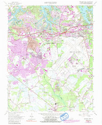
Editions of this 1965 Princess Anne Map
6 editions found
Other maps of this area

1893 · Virginia Beach
USGS Topo · 1:125,000

1907 · Norfolk
USGS Topo · 1:125,000

1916 · Back Bay
USGS Topo · 1:62,500

1918 · Cape Henry
USGS Topo · 1:62,500

1919 · Cape Henry
USGS Topo · 1:62,500

1939 · Moyock
USGS Topo · 1:62,500

1943 · Back Bay
USGS Topo · 1:62,500

1946 · Moyock
USGS Topo · 1:62,500

1946 · Eastville
USGS Topo · 1:250,000

1946 · Currituck Sound
USGS Topo · 1:250,000