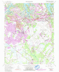
1965 Map of Princess Anne
USGS Topo · Published 1991About this map
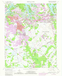
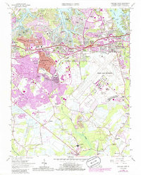
Oceana Naval Air Station dominates the eastern landscape of this coastal survey, reflecting the significant military presence integrated into the suburban growth of Virginia Beach. The map documents a period of rapid mid-century expansion, where residential developments like Princess Anne Plaza, Windsor Woods, and Thalia Village began to fill the spaces between historic creek systems. The geography is defined by the intricate fingers of the Eastern Branch Lynnhaven River and Western Br Lynnhaven R, which carved out points and coves like Witch Duck Point and Hebden Cove. Educational and community anchors such as the Tidwater Community College and Floyd E Kellam High Sch appear alongside established social hubs like the Bow Creek Country Club, illustrating the transition from a maritime-rural economy to a modern residential and naval center.
Find a feature on this map
88 named features on this map. Tap any name to fly to it.
Don’t see what you’re looking for? This feature index may not catch every label — zoom into the map to look around manually.
Map Details
Editions of this 1965 Princess Anne Map
6 editions found
Other maps of this area

1893 · Virginia Beach
USGS Topo · 1:125,000

1907 · Norfolk
USGS Topo · 1:125,000

1916 · Back Bay
USGS Topo · 1:62,500

1918 · Cape Henry
USGS Topo · 1:62,500

1919 · Cape Henry
USGS Topo · 1:62,500

1939 · Moyock
USGS Topo · 1:62,500

1943 · Back Bay
USGS Topo · 1:62,500

1946 · Moyock
USGS Topo · 1:62,500

1946 · Eastville
USGS Topo · 1:250,000

1946 · Currituck Sound
USGS Topo · 1:250,000