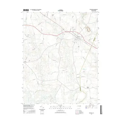
2016 Map of Princeton
USGS Topo · Published 2016About this map
Princeton serves as the primary hub on this Johnston County landscape, situated along the Norfolk Southern rail line. The town's layout is defined by streets like E Railroad Ave and S Center St, reflecting its historical reliance on the railroad for growth and commerce. To the west and south, the terrain transitions into a complex hydrologic network where Quincosin Swamp and Moccasin Creek drain toward the Neuse River, which meanders along the southern border. Scattered settlements and family-named landmarks provide significant detail for local historians, including Raynor Town near the Wayne County line and the small community of Brogden. Genealogists will find value in the specific locations of Thompson Cem and Overby Cem, while larger landmarks such as The Cowbone and Lake Lauderdale highlight the distinct local naming conventions of the era.
Find a feature on this map
87 named features on this map. Tap any name to fly to it.
Don’t see what you’re looking for? This feature index may not catch every label — zoom into the map to look around manually.
Map Details
Editions of this 2016 Princeton Map
This is the sole edition of this map. No revisions or reprints were ever made.
Other maps of this area

1902 · Kenly
USGS Topo · 1:62,500

1903 · Kenly
USGS Topo · 1:62,500

1906 · Four Oaks
USGS Topo · 1:48,000

1908 · Four Oaks
USGS Topo · 1:62,500

1953 · Raleigh
USGS Topo · 1:250,000

1954 · Raleigh
USGS Topo · 1:250,000

1964 · Selma
USGS Topo · 1:62,500

1964 · Selma
USGS Topo · 1:24,000

1974 · Grantham
USGS Topo · 1:24,000

1974 · Northwest Goldsboro
USGS Topo · 1:24,000