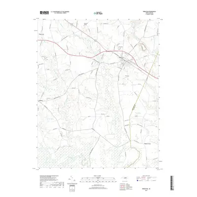
2019 Map of Princeton
USGS Topo · Published 2019About this map
Princeton and Pine Level anchor this survey of the Johnston and Wayne County borderlands, where the Southern railroad corridor dictates the local geography. The landscape is defined by its diverse wetlands and water systems, including the uniquely named The Cowbone and the wide bends of the Neuse River at the southern edge. Local genealogy is well-represented through family-named landmarks and resting places like Thompson Cem, Overby Cem, and the Bizzell Grove Memorial Gardens. This area shows a transition from structured town grids in Princeton to more dispersed rural settlements like Brogden and Raynor Town. The intricate drainage network of Moccasin Creek, Quincosin Swamp, and Raccoon Swamp suggests a territory where agricultural land and natural floodplains have long coexisted along the Little River basin.
Find a feature on this map
102 named features on this map. Tap any name to fly to it.
Don’t see what you’re looking for? This feature index may not catch every label — zoom into the map to look around manually.
Map Details
Editions of this 2019 Princeton Map
This is the sole edition of this map. No revisions or reprints were ever made.
Other maps of this area

1902 · Kenly
USGS Topo · 1:62,500

1903 · Kenly
USGS Topo · 1:62,500

1906 · Four Oaks
USGS Topo · 1:48,000

1908 · Four Oaks
USGS Topo · 1:62,500

1953 · Raleigh
USGS Topo · 1:250,000

1954 · Raleigh
USGS Topo · 1:250,000

1964 · Selma
USGS Topo · 1:62,500

1964 · Selma
USGS Topo · 1:24,000

1974 · Grantham
USGS Topo · 1:24,000

1974 · Northwest Goldsboro
USGS Topo · 1:24,000