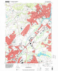
1995 Map of Princeton
USGS Topo · Published 2000About this map
Princeton serves as the academic and cultural heart of this mid-1990s landscape, dominated by the sprawling campus of Princeton University and the historic Theological Seminary. The map illustrates a dense network of prestigious educational institutions, including the Hun Sch and the Lawrenceville School, reflecting the region's long-standing focus on scholarship and elite training. To the south, the industrial and transport history of the corridor is evident where the Delaware and Raritan Canal parallels the Amtrak line, once vital arteries for commerce and now neighbors to residential expansion in Lawrenceville and Slackwoods.
Find a feature on this map
92 named features on this map. Tap any name to fly to it.
Don’t see what you’re looking for? This feature index may not catch every label — zoom into the map to look around manually.
Map Details
Editions of this 1995 Princeton Map
This is the sole edition of this map. No revisions or reprints were ever made.
Other maps of this area

1888 · Bordentown
USGS Topo · 1:62,500

1888 · Princeton
USGS Topo · 1:62,500

1890 · Lambertville
USGS Topo · 1:62,500

1890 · Burlington
USGS Topo · 1:62,500

1891 · Lambertville
USGS Topo · 1:62,500

1893 · Bordentown
USGS Topo · 1:62,500

1893 · Burlington
USGS Topo · 1:62,500

1894 · Princeton
USGS Topo · 1:62,500

1894 · Lambertville
USGS Topo · 1:62,500

1904 · Burlington
USGS Topo · 1:62,500