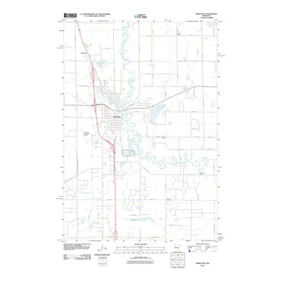
2010 Map of Princeton
USGS Topo · Published 2010About this map
The meandering Rum River defines the landscape of this 2010 survey, winding through the heart of Princeton and its surrounding rural townships. The map documents the city's residential expansion and modern infrastructure, including the Princeton Municipal Airport and the transition between developed neighborhoods and the agricultural tracts of Mille Lacs and Sherburne counties. Smaller water bodies like Silver Lake, Fog Lake, and Long Pond dot the terrain, while the historic settlement of Brickton appears to the north along the main transit corridor.
Find a feature on this map
56 named features on this map. Tap any name to fly to it.
Don’t see what you’re looking for? This feature index may not catch every label — zoom into the map to look around manually.
Map Details
Editions of this 2010 Princeton Map
This is the sole edition of this map. No revisions or reprints were ever made.
Other maps of this area

1916 · St. Francis
USGS Topo · 1:62,500

1919 · St. Francis
USGS Topo · 1:62,500

1953 · Stillwater
USGS Topo · 1:250,000

1955 · Stillwater
USGS Topo · 1:250,000

1958 · Stillwater
USGS Topo · 1:250,000

1961 · Orrock
USGS Topo · 1:24,000

1961 · Lake Fremont
USGS Topo · 1:24,000

1961 · Dalbo
USGS Topo · 1:24,000

1961 · Wyanett
USGS Topo · 1:24,000

1961 · Elk River
USGS Topo · 1:62,500
Featured Places
- Princeton, MN
- Wyanett Township, MN
- Spencer Brook Township, MN
- Baldwin Township, MN
- Princeton Township, MN