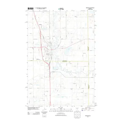
2013 Map of Princeton
USGS Topo · Published 2013About this map
The town of Princeton serves as the central hub of this modern survey, situated at the confluence of the Rum River and its west branch. The landscape is defined by the winding course of the river, which snakes through a terrain punctuated by water bodies like Fog Lake and Silver Lake. In the northern part of the quadrangle, the small settlement of Brickton appears along the highway corridor, while J Q Fruit Farm indicates local agricultural land use. To the west, the Princeton Municipal Airport occupies a significant portion of the landscape. This map provides critical documentation of the boundaries between Mille Lacs, Sherburne, and Isanti Counties, while offering genealogical value through the identification of local burial sites including Ebenezer Cemetery, Berry Cemetery, and Baldwin Cemetery. The road network is heavily developed around Rum River Drive and several county highways, reflecting the region's contemporary infrastructure and settlement patterns.
Find a feature on this map
28 named features on this map. Tap any name to fly to it.
Don’t see what you’re looking for? This feature index may not catch every label — zoom into the map to look around manually.
Map Details
Editions of this 2013 Princeton Map
This is the sole edition of this map. No revisions or reprints were ever made.
Other maps of this area

1916 · St. Francis
USGS Topo · 1:62,500

1919 · St. Francis
USGS Topo · 1:62,500

1953 · Stillwater
USGS Topo · 1:250,000

1955 · Stillwater
USGS Topo · 1:250,000

1958 · Stillwater
USGS Topo · 1:250,000

1961 · Orrock
USGS Topo · 1:24,000

1961 · Lake Fremont
USGS Topo · 1:24,000

1961 · Dalbo
USGS Topo · 1:24,000

1961 · Wyanett
USGS Topo · 1:24,000

1961 · Elk River
USGS Topo · 1:62,500
Featured Places
- Princeton, MN
- Wyanett Township, MN
- Spencer Brook Township, MN
- Baldwin Township, MN
- Princeton Township, MN