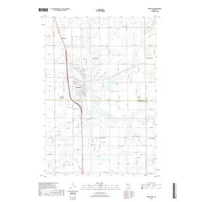
2019 Map of Princeton
USGS Topo · Published 2019About this map
Princeton serves as the central hub of this northern landscape where the Rum River and the W Br Rum River meet. The settlement pattern reveals the town's expansion south toward the Mille Lacs and Sherburne county line, while the northern reaches maintain a rural character defined by agricultural tracts and scattered water bodies like Fog Lake. Transport and commerce are anchored by the Princeton Municipal Airport and Reynolds Field, alongside the primary corridor of Brickton Road leading north to the settlement of Brickton. Local history is preserved at several points of interest, including the Ebenezer Cem in the northeast and Berry Cem further south. The map illustrates a transition from the structured street grid of the town center to the sprawling, lake-dotted wetlands of the surrounding plains.
Find a feature on this map
82 named features on this map. Tap any name to fly to it.
Don’t see what you’re looking for? This feature index may not catch every label — zoom into the map to look around manually.
Map Details
Editions of this 2019 Princeton Map
This is the sole edition of this map. No revisions or reprints were ever made.
Other maps of this area

1916 · St. Francis
USGS Topo · 1:62,500

1919 · St. Francis
USGS Topo · 1:62,500

1953 · Stillwater
USGS Topo · 1:250,000

1955 · Stillwater
USGS Topo · 1:250,000

1958 · Stillwater
USGS Topo · 1:250,000

1961 · Orrock
USGS Topo · 1:24,000

1961 · Lake Fremont
USGS Topo · 1:24,000

1961 · Dalbo
USGS Topo · 1:24,000

1961 · Wyanett
USGS Topo · 1:24,000

1961 · Elk River
USGS Topo · 1:62,500
Featured Places
- Princeton, MN
- Wyanett Township, MN
- Spencer Brook Township, MN
- Baldwin Township, MN
- Princeton Township, MN