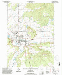
1992 Map of Prineville
USGS Topo · Published 1997About this map
Prineville sits at the confluence of several water systems, where the Crooked River meets Ochoco Creek amidst a network of irrigation infrastructure including the Ochoco Canal and the Ochoco Relift Pumping Plant. The town's mid-century layout is anchored by civic and community landmarks like the Courthouse, Pioneer Memorial Hospital, and the local Cem. To the east, the terrain rises sharply toward Barnes Butte, while Combs Flat and Juniper Canyon define the southern landscape.
Find a feature on this map
35 named features on this map. Tap any name to fly to it.
Don’t see what you’re looking for? This feature index may not catch every label — zoom into the map to look around manually.
Map Details
Editions of this 1992 Prineville Map
This is the sole edition of this map. No revisions or reprints were ever made.
Other maps of this area

1946 · Eagle Rock
USGS Topo · 1:62,500

1948 · Eagle Rock
USGS Topo · 1:62,500

1948 · Ochoco Reservoir
USGS Topo · 1:62,500

1950 · Ochoco Reservoir
USGS Topo · 1:62,500

1955 · Bend
USGS Topo · 1:250,000

1957 · Bend
USGS Topo · 1:250,000

1958 · Bend
USGS Topo · 1:250,000

1962 · Huston Lake
USGS Topo · 1:24,000

1962 · Prineville
USGS Topo · 1:24,000

1962 · Powell Buttes
USGS Topo · 1:62,500