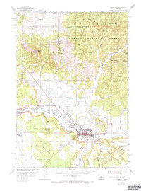
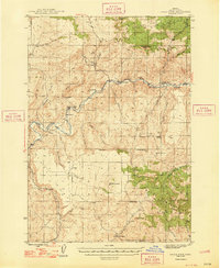
1962 Map of Prineville
USGS Topo · Published 1973About this map
The town of Prineville sits at the heart of this landscape where the Crooked River and Ochoco Creek converge, shaping the agricultural and civic life of the Ochoco Valley. In the early 1960s, the area reflects a transition between established ranching lands and modern municipal development, evidenced by the presence of the Prineville Airport, the Fairgrounds, and even a Drive-in Theater on the town's edge. To the north, the rugged southern slopes of Ochoco National Forest rise toward Grizzly Mountain, contrasting with the irrigated valley floors.
Find a feature on this map
57 named features on this map. Tap any name to fly to it.
Don’t see what you’re looking for? This feature index may not catch every label — zoom into the map to look around manually.
Map Details
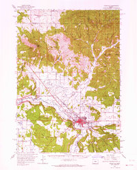
Editions of this 1962 Prineville Map
2 editions found
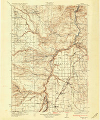
Other maps of this area

1926 · Bend
USGS Topo · 1:125,000

1928 · Madras
USGS Topo · 1:125,000

1929 · Bend
USGS Topo · 1:125,000
1931 · Madras
USGS Topo · 1:125,000
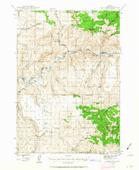
1946 · Eagle Rock
USGS Topo · 1:62,500
1948 · Eagle Rock
USGS Topo · 1:62,500
1948 · Ochoco Reservoir
USGS Topo · 1:62,500
1950 · Ochoco Reservoir
USGS Topo · 1:62,500

1955 · Bend
USGS Topo · 1:250,000

1957 · Bend
USGS Topo · 1:250,000