
1962 Map of Prineville
USGS Topo · Published 1964About this map
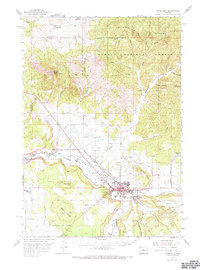
Prineville sits at the confluence of the Crooked River and Ochoce Creek, serving as the central hub of this Central Oregon landscape. The map reveals the town's mid-century expansion, featuring established civic infrastructure like the Jr H S, Fairgrounds, and the Prineville Airport. Surrounding the city, the Prineville Valley is dominated by agricultural patterns supported by the Main Canal, while the northern terrain rises sharply into the Ochogo National Forest.
Find a feature on this map
51 named features on this map. Tap any name to fly to it.
Don’t see what you’re looking for? This feature index may not catch every label — zoom into the map to look around manually.
Map Details
Editions of this 1962 Prineville Map
2 editions found
Other maps of this area

1926 · Bend
USGS Topo · 1:125,000

1928 · Madras
USGS Topo · 1:125,000

1929 · Bend
USGS Topo · 1:125,000

1931 · Madras
USGS Topo · 1:125,000

1946 · Eagle Rock
USGS Topo · 1:62,500

1948 · Eagle Rock
USGS Topo · 1:62,500

1948 · Ochoco Reservoir
USGS Topo · 1:62,500

1950 · Ochoco Reservoir
USGS Topo · 1:62,500

1955 · Bend
USGS Topo · 1:250,000

1957 · Bend
USGS Topo · 1:250,000