
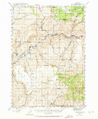
1946 Map of Eagle Rock
USGS Topo · Published 1963About this map
The Crooked River carves a deep path through this Central Oregon landscape, providing the lifeblood for a network of mid-century homesteads and livestock operations. The distribution of family-named holdings, such as Shorty Davis Ranch, Way Ranch, and Klaus Ranch, illustrates the post-war ranching economy in Crook County. These settlements are often positioned near vital water sources like O'Neil Creek or Eagle Creek to support agriculture on the high desert flats.
Find a feature on this map
45 named features on this map. Tap any name to fly to it.
Don’t see what you’re looking for? This feature index may not catch every label — zoom into the map to look around manually.
Map Details
Editions of this 1946 Eagle Rock Map
2 editions found
Other maps of this area

1948 · Eagle Rock
USGS Topo · 1:62,500

1948 · Ochoco Reservoir
USGS Topo · 1:62,500

1950 · Ochoco Reservoir
USGS Topo · 1:62,500

1951 · Post
USGS Topo · 1:62,500

1951 · Lookout Mtn
USGS Topo · 1:62,500

1955 · Crescent
USGS Topo · 1:250,000

1955 · Bend
USGS Topo · 1:250,000

1957 · Crescent
USGS Topo · 1:250,000

1957 · Bend
USGS Topo · 1:250,000

1958 · Crescent
USGS Topo · 1:250,000