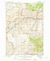
1946 Map of Eagle Rock
USGS Topo · Published 1973About this map
Crooked River snakes through this high desert region of Crook County, carving a canyon marked by river mile markers from Mile 75 to Mile 96. The mid-1940s landscape is defined by its ranching heritage, with large landholdings such as Riverside Ranch, Carey Ranch, and Kizer Ranch scattered along the watercourses and in the broader basins. These ranch complexes, along with the Bailey Sch and the settlement at Roberts, provided the social and economic framework for a sparse population focused on livestock.
Find a feature on this map
52 named features on this map. Tap any name to fly to it.
Don’t see what you’re looking for? This feature index may not catch every label — zoom into the map to look around manually.
Map Details
Editions of this 1946 Eagle Rock Map
2 editions found
Other maps of this area

1946 · Eagle Rock
USGS Topo · 1:62,500

1948 · Eagle Rock
USGS Topo · 1:62,500

1948 · Ochoco Reservoir
USGS Topo · 1:62,500

1950 · Ochoco Reservoir
USGS Topo · 1:62,500

1951 · Post
USGS Topo · 1:62,500

1951 · Lookout Mtn
USGS Topo · 1:62,500

1955 · Crescent
USGS Topo · 1:250,000

1955 · Bend
USGS Topo · 1:250,000

1957 · Crescent
USGS Topo · 1:250,000

1957 · Bend
USGS Topo · 1:250,000