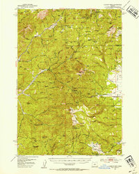
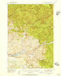
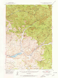
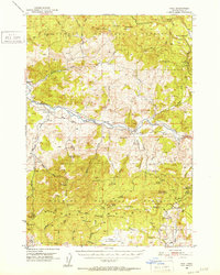
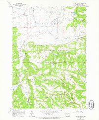
1951 Map of Lookout Mtn
USGS Topo · Published 1954About this map
Ochoco National Forest dominates this mid-century landscape, where mining operations and timber-management stations define the local activity. The presence of the Ochoco Mine, Amity Mine, and Independent Mine indicates the era's ongoing mineral extraction, while the Ochoco Ranger Sta serves as a hub for forest administration. High-altitude meadows and prairies, such as Indian Prairie and Grant Meadows, interrupt the forested peaks of the Lookout Mountain range, providing open ground for grazing, evidenced by the Sheep Corrals noted near Ochoco Butte.
Find a feature on this map
112 named features on this map. Tap any name to fly to it.
Don’t see what you’re looking for? This feature index may not catch every label — zoom into the map to look around manually.
Map Details
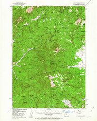
Editions of this 1951 Lookout Mtn Map
2 editions found
Other maps of this area

1926 · Mitchell
USGS Topo · 1:125,000
1946 · Eagle Rock
USGS Topo · 1:62,500
1948 · Eagle Rock
USGS Topo · 1:62,500
1948 · Ochoco Reservoir
USGS Topo · 1:62,500
1950 · Ochoco Reservoir
USGS Topo · 1:62,500
1951 · Post
USGS Topo · 1:62,500

1955 · Bend
USGS Topo · 1:250,000

1957 · Bend
USGS Topo · 1:250,000

1958 · Bend
USGS Topo · 1:250,000
1965 · Williams Prairie
USGS Topo · 1:24,000