
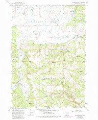
1965 Map of Williams Prairie
USGS Topo · Published 1967About this map
Big Summit Prairie dominates the northern landscape of this mid-1960s survey, representing a significant high-altitude basin within the Ochocco National Forest. The map documents a sophisticated network of water management and forest service infrastructure, featuring numerous catchments like Peterson Creek Reservoir and Hickey Reservoir. The presence of the Cold Springs Guard Station and its adjacent landing field indicates the area's importance for forest management and fire observation during this era. Movement through this high country is defined by routes such as the Arvid Nelson Road, which skirts the transition from open grasslands to the timbered reaches of Fox Canyon. This survey captures a moment of managed wilderness, where natural springs like Indian Trail Spring and Williams Spring coexist with man-made improvements for ranching and resource protection.
Find a feature on this map
48 named features on this map. Tap any name to fly to it.
Don’t see what you’re looking for? This feature index may not catch every label — zoom into the map to look around manually.
Map Details
Editions of this 1965 Williams Prairie Map
2 editions found
Other maps of this area

1951 · Post
USGS Topo · 1:62,500

1951 · Lookout Mtn
USGS Topo · 1:62,500

1955 · Bend
USGS Topo · 1:250,000

1957 · Bend
USGS Topo · 1:250,000

1958 · Bend
USGS Topo · 1:250,000

1966 · Keys Creek
USGS Topo · 1:24,000

1966 · Peterson Point
USGS Topo · 1:24,000

1966 · Mt. Pisgah
USGS Topo · 1:24,000

1981 · Prineville
USGS Topo · 1:100,000
1982 · Rabbit Valley
USGS Topo · 1:24,000