
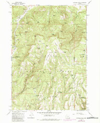
1966 Map of Peterson Point
USGS Topo · Published 1968About this map
Och Oco National Forest land dominates this high-elevation terrain where the border of Wheeler and Crook counties bisects the landscape. The geography is defined by volcanic features and a sophisticated network of seasonal water sources, featuring geologic landmarks like Broadway Lava and Jones Lava. Higher elevations are marked by Peterson Point and Black Mtn, providing a backdrop for the numerous pack and jeep trails that supported forest management and range use in the mid-1960s.
Find a feature on this map
68 named features on this map. Tap any name to fly to it.
Don’t see what you’re looking for? This feature index may not catch every label — zoom into the map to look around manually.
Map Details
Editions of this 1966 Peterson Point Map
2 editions found
Other maps of this area

1926 · Mitchell
USGS Topo · 1:125,000

1932 · Dayville
USGS Topo · 1:125,000

1936 · Dayville
USGS Topo · 1:125,000

1953 · Richmond
USGS Topo · 1:62,500

1955 · Bend
USGS Topo · 1:250,000

1955 · Canyon City
USGS Topo · 1:250,000

1957 · Bend
USGS Topo · 1:250,000

1958 · Bend
USGS Topo · 1:250,000

1959 · Canyon City
USGS Topo · 1:250,000

1965 · Williams Prairie
USGS Topo · 1:24,000