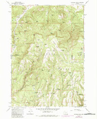
1966 Map of Peterson Point
USGS Topo · Published 1985About this map
Ochoco National Forest defines the rugged landscape of this central Oregon quadrangle, where the boundary between Wheeler and Crook counties cuts through dense contour lines. The terrain is characterized by a complex network of springs and drainages, with Peterson Point and Black Mtn serving as prominent high points. Local water sources are abundant, with family-named or descriptive locations such as Dick Nicholas Spring, Monroe Spring, and Rainier Spring providing critical points of interest for historical land use. The presence of numerous trails and pack trails winding through the timber indicates a landscape managed for both recreation and resource access. Small clearings like Happy Camp Campground and Lonesome Spring Campground mark the few established human outposts in this heavily forested area, while the course of Milk Creek and Badger Creek shape the drainage patterns of the high country.
Find a feature on this map
64 named features on this map. Tap any name to fly to it.
Don’t see what you’re looking for? This feature index may not catch every label — zoom into the map to look around manually.
Map Details
Editions of this 1966 Peterson Point Map
2 editions found

Other maps of this area

1926 · Mitchell
USGS Topo · 1:125,000

1932 · Dayville
USGS Topo · 1:125,000

1936 · Dayville
USGS Topo · 1:125,000

1953 · Richmond
USGS Topo · 1:62,500

1955 · Bend
USGS Topo · 1:250,000

1955 · Canyon City
USGS Topo · 1:250,000

1957 · Bend
USGS Topo · 1:250,000

1958 · Bend
USGS Topo · 1:250,000

1959 · Canyon City
USGS Topo · 1:250,000

1965 · Williams Prairie
USGS Topo · 1:24,000