
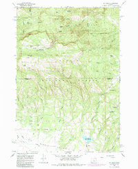
1966 Map of Mt. Pisgah
USGS Topo · Published 1968About this map
Mt Pisgah dominates this high-altitude landscape in central Oregon, where the summit is capped by a Lookout Tower overlooking the deep drainage basins of the Ochco National Forest. The map captures a mid-1960s environment defined by water management and forest service infrastructure, featuring several significant water bodies including Yellowjacket Reservoir, Ross Reservoir, and the Allen Creek Res. Local history is reflected in the numerous seasonal camps and outposts such as Wineburger Camp, Scotts Campground, and Carrol Campground, which served as hubs for range management and forestry. The topography is intricately detailed, showing the network of streams like Bridge Creek and Milk Creek that descend from high points like North Point toward Summit Prairie. Numerous springs, including Mud Spring and North Pisgah Spring, indicate the vital water sources utilized by early settlers and foresters across the Wheeler County and Crook County line.
Find a feature on this map
47 named features on this map. Tap any name to fly to it.
Don’t see what you’re looking for? This feature index may not catch every label — zoom into the map to look around manually.
Map Details
Editions of this 1966 Mt. Pisgah Map
2 editions found
Other maps of this area

1926 · Mitchell
USGS Topo · 1:125,000

1951 · Lookout Mtn
USGS Topo · 1:62,500

1955 · Bend
USGS Topo · 1:250,000

1957 · Bend
USGS Topo · 1:250,000

1958 · Bend
USGS Topo · 1:250,000

1965 · Williams Prairie
USGS Topo · 1:24,000

1966 · Keys Creek
USGS Topo · 1:24,000

1966 · Peterson Point
USGS Topo · 1:24,000

1966 · Mitchell
USGS Topo · 1:62,500

1968 · Lawson Mtn
USGS Topo · 1:24,000