
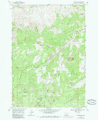
1968 Map of Lawson Mtn
USGS Topo · Published 1972About this map
Lawson Mtn and the surrounding high country of the Ochoc o National Forest dominate this late-1960s survey of Wheeler County. The landscape is defined by its dramatic volcanic and erosional features, including the prominent Courthouse Rock and the high points of Sand Mountain and Black Butte. Human presence is sparse, centered primarily on the historic cattle ranching culture evidenced by the Fitzgerald Ranch in the north and the West Branch Cemetery nestled in the central valley.
Find a feature on this map
45 named features on this map. Tap any name to fly to it.
Don’t see what you’re looking for? This feature index may not catch every label — zoom into the map to look around manually.
Map Details
Editions of this 1968 Lawson Mtn Map
2 editions found
Other maps of this area

1926 · Mitchell
USGS Topo · 1:125,000

1951 · Lookout Mtn
USGS Topo · 1:62,500

1955 · Bend
USGS Topo · 1:250,000

1957 · Bend
USGS Topo · 1:250,000

1958 · Bend
USGS Topo · 1:250,000

1966 · Mt. Pisgah
USGS Topo · 1:24,000

1966 · Mitchell
USGS Topo · 1:62,500

1968 · Painted Hills
USGS Topo · 1:24,000

1968 · Stephenson Mtn
USGS Topo · 1:24,000
1968 · Sandrock Mtn
USGS Topo · 1:24,000