
1968 Map of Painted Hills
USGS Topo · Published 1972About this map
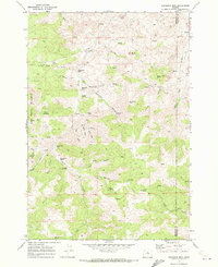
The John Day River winds through the northern reaches of this landscape, carving a path past Burnt Ranch and Byros Point in a region defined by dramatic erosion and ranching history. To the south, the iconic geologic formations of the Painted Hills are preserved within the Painted Hills State Park, where Bridge Creek flows through the center of the terrain. The map records a network of drainage systems including Coyote Canyon, Pats Cabin Canyon, and Lockwood Canyon, which cut through the high ridges. Isolated water sources such as Stovepipe Spring and several unnamed springs are critical markers in this arid environment. Traces of local enterprise are visible at the Taylor Ranch and scattered utilitarian features like a Gravel Pit and Borrow Pit, while a Jeep Trail provides one of the few ways to traverse the interior heights.
Find a feature on this map
21 named features on this map. Tap any name to fly to it.
Don’t see what you’re looking for? This feature index may not catch every label — zoom into the map to look around manually.
Map Details
Editions of this 1968 Painted Hills Map
This is the sole edition of this map. No revisions or reprints were ever made.
Other maps of this area

1926 · Mitchell
USGS Topo · 1:125,000

1955 · Bend
USGS Topo · 1:250,000

1957 · Bend
USGS Topo · 1:250,000

1958 · Bend
USGS Topo · 1:250,000

1966 · Mitchell
USGS Topo · 1:62,500

1966 · Kinzua
USGS Topo · 1:62,500

1966 · Clarno
USGS Topo · 1:62,500

1968 · Lawson Mtn
USGS Topo · 1:24,000

1968 · Stephenson Mtn
USGS Topo · 1:24,000
1968 · Sandrock Mtn
USGS Topo · 1:24,000